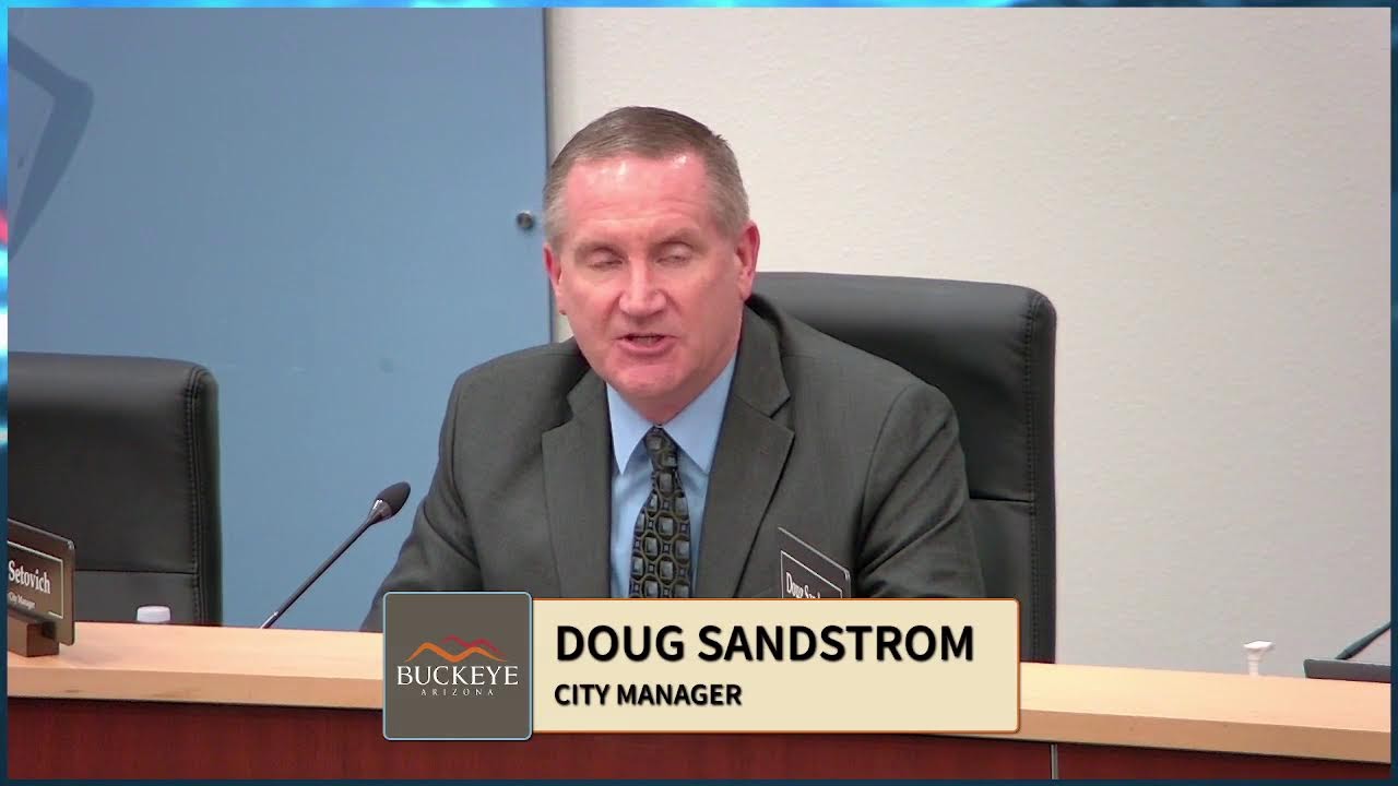
Buckeye unanimously approves 1,919-acre Grand View Buckeye annexation and $10-million economic development project
City Council unanimously approved major economic development projects including the 1,919-acre Grand View Buckeye mega-site annexation and CMP with infrastructure reimbursement agreements, amid concerns from property owners about State Route 30 alignment and historic preservation.
Buckeye Approves Landmark 1,919-Acre Grand View Mega-Site Annexation; Clarifies it Does Not Endorse State Route 30 Alignment
On April 8, 2026, the Buckeye City Council unanimously approved one of the largest economic-development projects in the Phoenix metropolitan area: the annexation and rezoning of 1,919 acres for the Grand View Buckeye community, a rail-served regional industrial hub designed to attract advanced-manufacturing and data-center operators. The approval came after a contentious public-comment period in which two property owners in the adjacent Liberty area raised concerns that showing a conceptual State Route 30 alignment in the Community Master Plan (CMP) could set an unfavorable precedent for routing that highway corridor through historic sites and flood-plain areas. Eric Orsborn and City Attorney Tosca clarified for the record that the alignment is conceptual only and not endorsed by the city.
The meeting also featured a charged dispute over Miller Road street-assessment methodology, approval of two smaller annexations, and a continuation of the water and wastewater rate-increase hearing to May 5 to allow for further public outreach.
Key Speeches
"The development agreement reimbursement framework contemplates reimbursement from tax revenues received by the city from construction sales tax, primary real and personal property taxes, as well as lease taxes generated from eligible uses as defined in the agreement. These are the types of uses such as data center, advanced manufacturing, biomedical device research, development, manufacturing, etc. and similar uses." — City Attorney Tosca, addressing the infrastructure-reimbursement mechanism
"I'm not here to speak against the Vander Waal's project. It looks like it's world class to me. What I'm concerned about is any mention of the State Route 30 in these documents. Like Daryl said, it sets a type of a precedence or it looks like it puts your imprimatur on it that you're approving of that." — Steven Bales Jr., property owner and historian, raising concerns about State Route 30 routing
"I know there's State Route 30 is not that corridor has not been defined yet. And there's a lengthy process, a lot of input from stakeholders all up and down this State Route 30 that determine where that route goes. The significance of showing it where it's shown on here is really just for conceptual purposes from my perspective." — Mayor Eric Orsborn, addressing alignment concerns
"I'm incredibly grateful for all the work that you all have put in on this piece of property, and this is I think one of the most premier mega site project sites in the entire metro Phoenix area. Rail served, water, power right across the street in a couple of substations, and I don't think there's any other site that compares to this one either in Buckeye or across metro Phoenix." — Eric Orsborn, concluding remarks on Grand View
Timeline
Agenda Item 5D – Grand View Buckeye Annexation (Ordinance 08-26)
Applicant presentation: Ken Glica, Development Services Director, presented the annexation of 1,919 acres bounded by Broadway Road to the north, Jackrabbit Trail to the east, MC 85 to the south, and Dean Road to the west. The site is currently agricultural, bisected by Union Pacific Railroad tracks and the Buckeye Canal. General plan was amended in 2021 to designate the area for employment use, with the intent to attract a "mega user"—such as an advanced automotive manufacturer or large industrial operator. The blank petition was recorded; the first public hearing occurred in August 2025 (approximately nine months prior). All state statutory requirements for annexation were satisfied. Staff recommended approval.
Public comment: Two speakers raised concerns about State Route 30. Daryl Kuiper, a property owner in the Liberty area with half-mile frontage across historic sites (a school and Methodist Church), expressed concern that the CMP's conceptual State Route 30 alignment along MC 85 would set a precedent for routing through flood plains and historic properties. He referenced a 2005–2006 sewer study that hit shallow water 10–14 feet deep, suggesting that the Beloat Road corridor would face similar water challenges. Steven Bales Jr., a descendant of the Beloat and Bales pioneer families (homesteaded since 1882), provided extensive historical context, explaining the naming of Beloat Road and the family's 144-year presence in the area. He stated he did not oppose the Grand View project itself but was concerned that including State Route 30 language in the CMP amounted to the city endorsing a specific alignment, when that decision should involve county, state, and stakeholder participation.
Council discussion: Eric Orsborn acknowledged the lengthy ADOT/MAG process for determining the SR 30 corridor and stated that showing the alignment on the CMP is "conceptual" and not an endorsement. He emphasized that the city's goal is to ensure the highway does not bisect the Grand View property, but beyond that, the alignment decision is ADOT's and MAG's to make over time.
Ken Glica clarified that the CMP includes language stating the alignment is "conceptual" and notes that the intent is not to bisect the property. He suggested that the record (tonight's council comments) should be consulted by future planners and engineers to understand that the city is not endorsing the specific alignment.
City Attorney Tosca stated that, in her opinion, the CMP's existing verbiage is sufficiently clear that the city is not approving SR 30 as an option. She advised that no further amendment is necessary, though the council's statements on the record provide additional clarity.
Vote: Unanimous approval of Ordinance 08-26.
Agenda Item 5E – Grand View Community Master Plan and Development Agreement (Ordinances 09-26 and 10-26)
Applicant presentation: Ken Glica presented the CMP and 25-year Development Agreement. The CMP establishes three land-use districts: an employment district (purple) permitting light industrial on the periphery and heavier industrial in the interior; a residential village district (yellow) allowing up to 750 acres and approximately 6,500 residential units at a target density of 6.75 units per acre (single-family or multifamily, though multifamily capped at 150 acres); and a commercial district (red) with a minimum of 32 acres for community-serving retail, restaurants, and offices. The employment district is the priority: if a mega user wants the entire property, they can develop it as industrial without being required to build residential or commercial components. Light industrial uses on the exterior (within 500 feet of streets) are enclosed only; heavier industrial is permitted only in the interior. Prohibited uses include marijuana-related establishments and junkyards. Rail access is prioritized (the site fronts nearly 2 miles of Union Pacific tracks).
Water and wastewater can be provided by the city (the developer constructs regional facilities and transfers them to the city) or self-served (well and private sewer). Public safety facilities will be located on a city-consented site off Jackrabbit Avenue. The development agreement includes infrastructure-reimbursement provisions for water/wastewater facilities, fire equipment, and a permanent public safety facility, funded from tax revenues (construction sales tax, property tax, lease tax) generated by eligible uses (data centers, advanced manufacturing, biomedical research) on the Grand View property. Reimbursement eligibility begins after the city receives $10 million in revenues from eligible uses.
Public comment: One speaker request card was submitted for Rick Ladra, but he did not appear. No public comment was received.
Council discussion: Clay Goodman asked about the infrastructure-reimbursement structure and where the funds come from. City Attorney Tosca explained that reimbursement comes from new tax revenues generated on the Grand View property itself, not from other city funds or properties.
Patrick HagEstad asked whether the developer could self-service water and wastewater and whether a Community Facilities District (CFD) would be established. Tosca clarified that the development agreement provides flexibility: if the developer self-serves (operates its own water/wastewater systems), the city does not operate or maintain those facilities. If the developer turns the facilities over to the city and they include oversized or regional components, those portions are eligible for reimbursement; the local portion serving only the property itself is not.
Eric Orsborn made closing remarks celebrating the project as "one of the most premier mega site project sites in the entire metro Phoenix area" and thanked the applicant and staff for years of work.
Vote: Unanimous approval of Ordinances 09-26 and 10-26.
Agenda Item 5A – Miller Road Street Improvements Assessment (Resolution 30-26)
Applicant presentation: Riley Quinlan, Program Management Office, presented Resolution 30-26 for the Miller Road project (Pima to Lower Buckeye Road), completed at the end of 2025. In May 2022, the city issued a Determination of Necessity based on a 60% cost estimate, identifying 11 benefiting parcels. Over 2022–2025, design and construction evolved, and the assessment is now based on actual costs. The project includes roadway paving, grading, curb, gutter, sidewalk, ITS, and landscape improvements. The assessment overall increased by approximately 10%, which beats the 14% Arizona Department of Transportation construction-cost index inflation during the same period.
Public comment: Samantha DeMoss, on behalf of 8THVG AZ Buckeye (owner of a parcel at the southeast corner of Miller Road and Watkins), objected to the assessment methodology. While the overall project cost increased by 5%, her parcel's assessment increased by 48% (approximately $220,000). She requested line-item documentation to determine whether the increase applied to her parcel alone or was distributed across the entire project.
Council discussion: Clay Goodman asked how the initial 60% estimate was communicated to property owners and whether they were made clear it was an estimate subject to change. Riley Quinlan confirmed that all correspondence from 2022 onward contained disclaimers that estimates were provisional and would be reconciled with actual costs. The scope evolved as design progressed and as the owner (the veterinary clinic under construction) clarified its site plan. Water, sewer, rough half-street improvements for Watkins tie-in, and drainage improvements were added during design evolution and were not reflected in the 2022 estimate because the parcel's inclusion was not known at that time. Riley provided a detailed cost breakdown showing that water, sewer, and drainage infrastructure accounted for the lion's share of the increase.
Clay Goodman also asked whether bond funds were used. Riley confirmed that the Miller Road project was funded primarily with general-fund dollars, predating the city's bond issuance.
Vote: Unanimous approval of Resolution 30-26, which overruled two written objections received during the public-comment period.
Agenda Items 5B and 5C – Small Annexations
Item 5B – MC 85/SR 85 Annexation (Ordinance 06-26): Mandy Woods presented the annexation of 0.89 acres at the northeast corner of MC 85 and SR 85, currently an existing convenience store with gas sales. Upon annexation, the parcel is assigned initial C3 (Regional Commercial) zoning, which allows the existing use. No rezoning or development plans are anticipated; the property will connect to city water. No speakers. Unanimously approved.
Item 5C – Buckeye 83 Annexation (Ordinance 07-26): Ken Glica presented the annexation of 85 acres at the southeast corner of I-10 and SR 85, bisected by 266th Avenue. The area is surrounded by vacant land; Westpark residential and commercial uses are expected nearby. General plan designates the site as "business commerce." Upon annexation, the parcel is assigned R1-43 (residential, large-lot) zoning; future rezoning to Business Park is anticipated. No rezoning is requested tonight. Craig Heustis asked about access; Ken confirmed that primary access will be via SR 85 via Broadway, then via future 266th Avenue, with an alternate via I-10 to Durango. No direct access through Westpark is planned. No speakers. Unanimously approved.
Agenda Item 5F – Water and Wastewater Rate Schedule (Resolution 32-26) – Continued
Staff request: Staff requested continuation of the public hearing on water and wastewater rates (Resolution 32-26) to May 5, 2026, at 6:00 p.m., to allow for additional public outreach.
Public comment (outside the public hearing record): Jamaine Berry, a resident of Sun City Festival (a 55-plus community in Festival Ranch), stated that residents understand the need for a rate increase but objected to the categorization of HOA water consumption as "commercial." HOAs service common areas (landscaping, amenities) primarily used by residents, and a commercial rate imposes costs that are passed through to residents as HOA-fee increases. He requested a dedicated HOA rate category.
Steve Sterling, a Buckeye resident, noted that the city had reported in 2023 that its water situation was "secure" and "healthy," yet now a rate increase is proposed. He attributed this to ongoing state negotiations over water rights, which he acknowledged are inevitable. He urged the council to delay the rate increase by at least 12 months to ease the burden on families already struggling with inflation.
Vote: Unanimous continuation to May 5, 2026.
Agenda Item 2 – Public Comment on Non-Agenda Items
Kenny Walls brought a request for the city to consider establishing an RV dump-station facility. Walls noted that private facilities at Loves and Lee 30 are no longer available, creating a shortage in the area. He suggested that the city's sanitation and reclamation facilities could potentially host such a facility and that the tax revenue from RV-fuel sales could support it.
Eric Orsborn referred Walls to Terry Lowe, the Water Resources Director, for future consideration.
Opposition
State Route 30 Alignment Concerns:
- Number of speakers: 2 (Daryl Kuiper, Steven Bales Jr.)
- Main concerns:
- The CMP's depiction of a conceptual State Route 30 alignment along MC 85 could set a precedent for routing the highway through historic sites (Liberty school, Methodist Church) on properties of legacy landowners.
- Shallow groundwater (10–14 feet deep, per 2005–2006 sewer studies) in the Beloat Road/Liberty area makes that corridor problematic for major infrastructure.
- Including State Route 30 alignment language in a city-approved CMP amounts to the city endorsing a specific route, when the decision should involve ADOT, MAG, and all affected stakeholders.
- The routing decision is complex and multi-jurisdictional; the city should not pre-empt or signal preference.
- If SR 30 is not routed through Grand View, it could fall on legacy properties south of MC 85, affecting families like the Bales and Kuiper families who have farmed the area since 1882.
- Most compelling arguments:
- Steven Bales Jr.'s historical testimony: He traced his family's presence in the area to 1882 (his great-grandfather's homestead), and Beloat Road was named after the Beloat family (from whom Bales descended via his grandmother). The emotional and historical weight of this argument underscored the stakes for long-time residents.
- Daryl Kuiper's technical concern: The groundwater challenge in the Beloat corridor (evidenced by a failed 2005–2006 sewer-study test hole) is a material engineering issue that could affect flood plains and infrastructure viability.
- Organized groups: None; two individual property owners speaking in their own capacity.
Miller Road Assessment Dispute:
- Number of speakers: 1 (Samantha DeMoss, 8THVG AZ Buckeye)
- Main concern: A 48% cost increase for one parcel versus a 5% project-wide increase suggests either a methodological error or an undisclosed scope increase unique to that parcel. The speaker requested line-item documentation.
- Outcome: Riley Quinlan provided a detailed explanation: water, sewer, and drainage improvements tied to the owner's site plan (veterinary clinic) were added during design evolution and were not anticipated in the 2022 estimate. The speaker's objection was overruled when the city attorney confirmed that Resolution 30-26 provides for overruling written objections per state law.
Support
Grand View Buckeye Project: No speakers spoke against the project itself; all public comment focused narrowly on the State Route 30 alignment, not the annexation or rezoning. This implied broad support for the economic-development vision.
Miller Road Assessment: No speakers supported the resolution during the public hearing; the council approved it without enthusiastic public endorsement.
Project Details
Grand View Buckeye Mega-Site
- Case number: PLZM-25-0008 (and separate ordinances 08-26, 09-26, 10-26)
- Applicant / developer: Grand View Buckeye LLC; represented by Alan Bodwin, Norris Design
- Attorney: Not explicitly named; city attorney is Tosca; Wendy Rudell, Berry Rudell Law Firm, represented a separate annexation applicant (Buckeye 83)
- Location / address: Generally bounded by Broadway Road (north), Jackrabbit Trail (east), MC 85 (south), Dean Road (west); the property extends across approximately 1,919 acres in Maricopa County, currently unincorporated
- APN: Not stated in transcript
- Current zoning → Proposed zoning: Mix of R1-43, I-1, and rural residential (county) and city zoning → Community Master Plan (CMP) with three land-use districts: Employment (light and heavy industrial), Residential Village (up to 6,500 units at 6.75 du/ac target), and Commercial (minimum 32 acres)
- Density / units / square footage:
- Residential village: up to 750 acres, approximately 6,500 units maximum (no requirement to build)
- Target density: 6.75 du/ac
- Commercial: minimum 32 acres
- Employment: no density cap; entire 1,919 acres can be industrial if a mega user desires
- Setbacks and buffers: 150-foot setback for service areas (double the standard) when adjacent to residential; 30-foot landscape buffer required; light industrial only on perimeter (within 500 feet of streets)
- Rail access: Property fronts approximately 2 miles of Union Pacific Railroad tracks (north-south bisecting the site)
- Water/wastewater: Two options—(1) city-provided (developer constructs and transfers regional facilities) or (2) self-served (developer's well and private sewer). If city-provided, oversized or regional portions eligible for reimbursement.
- Public safety: Dedicated land and facilities for joint police/fire station off Jackrabbit Avenue; developer covers construction and up to two years of maintenance/operations.
- Development agreement term: 25 years
Miller Road Street Improvements
- Case number: CIP #105260
- Location: Pima Street to Lower Buckeye Road (south of I-10)
- Project type: Street widening, utilities, landscape improvements
- Cost estimate (2022): ~60% preliminary estimate
- Actual cost (2025): Approximately 10% above the 2022 estimate; well below the 14% ADOT construction-cost index inflation
- Funding: General fund (not bonds)
- Affected parcels: 11 benefiting parcels assessed for improvements; two written objections received and overruled
Smaller Annexations
- Item 5B (Ordinance 06-26): 0.89 acres, NE corner MC 85/SR 85, existing convenience store with gas sales, assigned C3 zoning
- Item 5C (Ordinance 07-26): 85 acres, SE corner I-10/SR 85 (Buckeye 83), assigned R1-43 zoning pending future Business Park rezoning
Vote Breakdown
Consent Agenda (Item 4A–4X)
- Final: Unanimous
- Outcome: Approved
Item 5A – Resolution 30-26 (Miller Road Assessment)
- Final: Unanimous
- Outcome: Approved; overrules 2 written objections per state law
- Votes: Not individually named
Item 5B – Ordinance 06-26 (MC 85/SR 85 Annexation)
- Final: Unanimous
- Outcome: Approved
- Votes: Not individually named
Item 5C – Ordinance 07-26 (Buckeye 83 Annexation)
- Final: Unanimous
- Outcome: Approved
- Votes: Not individually named
Item 5D – Ordinance 08-26 (Grand View Annexation)
- Final: Unanimous
- Outcome: Approved
- Votes: Not individually named
Item 5E – Ordinances 09-26 and 10-26 (Grand View CMP and Development Agreement)
- Final: Unanimous
- Outcome: Approved
- Votes: Not individually named
Item 5F – Continuation to May 5, 2026
- Final: Unanimous
- Outcome: Public hearing continued
Note: Individual council-member votes were not recorded or stated in the transcript. All votes were called as unanimous "ayes" with no stated "nays."
Outcome & Next Steps
Grand View Buckeye:
- Ordinance 08-26 (annexation) is now effective.
- Ordinances 09-26 and 10-26 (CMP and development agreement) are now in effect.
- The 25-year development agreement establishes a framework for infrastructure reimbursement tied to new tax revenues (construction sales tax, property tax, lease tax) from eligible uses on the property.
- No immediate development is planned; the site remains agricultural and open for marketing to potential mega-users (advanced manufacturing, data centers, biomedical research).
- The record is clear that the city does not endorse any specific State Route 30 alignment; that determination remains with ADOT and MAG.
Miller Road:
- Resolution 30-26 is approved and recorded against the 11 benefiting parcels.
- Assessments will not be due until the time of development, with a 10-year collection window.
- The assessment on 8THVG AZ Buckeye's parcel (approximately $220,000 additional due to scope changes) is upheld; the owner may pursue further administrative or legal remedies outside this council forum.
Water/Wastewater Rates:
- Public hearing is continued to May 5, 2026, at 6:00 p.m.
- The city will conduct additional public outreach between now and then.
- Staff will review concerns raised by Jamaine Berry regarding HOA rate categorization and by Steve Sterling regarding the timing of the rate increase.
RV Dump Station:
- Kenny Walls' request is referred to Terry Lowe (Water Resources Director) for future feasibility study and consideration.
Controversies & Context
State Route 30 Corridor Controversy
The central tension of the meeting was whether a city-approved CMP should include a conceptual depiction of the State Route 30 alignment. Two speakers—Daryl Kuiper and Steven Bales Jr.—argued that doing so amounted to an endorsement that could prejudice future state and regional decision-making. Their concerns were rooted in:
-
Historic preservation: The Liberty area (south and east of the Grand View property) contains pioneer-era structures, including the Beloat family homestead (1882) and a Methodist Church. State Route 30, if routed through that corridor, could conflict with preservation goals.
-
Flood-plain risk: Both speakers cited a failed 2005–2006 sewer-study test hole that struck water at 10–14 feet, suggesting shallow groundwater in the Beloat Road area. A major highway corridor there could exacerbate flood risks or face engineering challenges.
-
Precedent and preemption: Including the alignment in a city-approved document, they argued, could signal city endorsement and pre-empt the multi-year, multi-agency process (ADOT, MAG, Pinal County, other municipalities) that typically determines highway corridors. Steven Bales Jr. emphasized that the decision should be made with full stakeholder participation, not through a city zoning document.
Eric Orsborn and staff responded by emphasizing that:
- The alignment is shown for "conceptual purposes" only.
- The CMP narrative states that the alignment is not binding and that no bisection of the Grand View property is preferred.
- The city is not endorsing any specific route; ADOT and MAG will make that determination based on a lengthy process.
- The council's statements on the record (tonight's meeting) serve as a clear signal to future planners that the city is not pre-judging the SR 30 corridor.
City Attorney Tosca advised that the existing CMP language is sufficiently clear and that no amendment is needed, though the council's verbal clarifications provide additional certainty.
Miller Road Assessment Dispute
The 48% cost increase for 8THVG AZ Buckeye's parcel raised questions about assessment methodology and transparency. The concern was whether:
- The assessment calculation was erroneous.
- The scope of work for the entire project changed, and the parcel's share was calculated incorrectly.
- Scope changes specific to the parcel (water, sewer, drainage for the veterinary clinic) were imposed without the owner's knowledge or consent.
Riley Quinlan's response—that design evolution and site-specific needs for the veterinary clinic prompted infrastructure additions—addressed the concern substantively, but the speaker's request for line-item documentation was not fully satisfied on the record. The city attorney confirmed that state law permits overruling written objections if the assessment process followed statutory procedure, which it did.
Water Rights and Rate-Increase Context
Steve Sterling's comment about state water-rights negotiations underscores a broader Arizona context: the state is in ongoing negotiations with California and Nevada over Colorado River allocations, and Buckeye (like other Arizona municipalities) faces uncertainty about water availability and cost. This is not a Buckeye-specific controversy but a statewide fiscal pressure. The 2023 news reports Sterling referenced touted Buckeye's "secure" water position; the 2026 rate increase is explained by the state-level negotiations and the need to plan for contingencies.
Tom Berry's HOA-rate categorization concern is a more parochial issue: how to classify common-area irrigation and amenity water (which is essential to HOA operations and resident quality of life) for rate-setting purposes. His argument is that HOAs perform a quasi-residential function and should not be charged at commercial rates, which incentivize cost-minimization that gets passed to residents. This concern was referred to Terry Lowe for administrative consideration.
Historical and Emotional Dimension
Steven Bales Jr.'s extended testimony about his family's 144-year presence in the Liberty area, including the homestead dating to 1882 and the Methodist Church where his great-grandparents were married, added an emotional and historical dimension to the SR 30 debate. His remarks made clear that the "Liberty area" is not just a parcel on a map but a place of family legacy and meaning. The mention of Beloat Road being named in honor of the pioneer family underscored the interconnection of geography, history, and identity in Buckeye's rural past. While this did not change the council's vote, it provided context for why the SR 30 routing question matters to a subset of the community.
Duration
- Item 5A (Miller Road): Approximately 20 minutes (staff presentation, public comment, council discussion)
- Items 5B–5C (Small annexations): Approximately 15 minutes combined
- Items 5D–5E (Grand View): Approximately 90 minutes (lengthy staff presentation, two public speakers, council discussion, clarifications)
- Item 5F (Water rates): Approximately 15 minutes (two public speakers, continuance motion)
- Item 2 (RV dump stations): Approximately 5 minutes
- Total meeting: Approximately 3 hours
Other Notable Items
RV Dump Station Request: Kenny Walls brought a non-agenda item requesting the city consider establishing an RV dump-station facility, noting that private providers at Loves and Lee 30 have closed. The request was referred to Water Resources Director Terry Lowe for feasibility study, suggesting a potential future capital or enterprise-fund project.
View source transcript ▼
Source: Buckeye City Council Meeting 4-7-2026 — April 7, 2026. Auto-generated YouTube transcript; may contain transcription errors.
Okay, we'll call this meeting to order. This is the city of Buckeye Council meeting for April 7th, 2026. We're going to begin tonight with the invocation led by Pastor Darius Sanders from Palm Valley Church followed by the pledge led by Council Member Haggard. Let's pray. God, thank you so much for this night tonight. This opportunity we get to come to you in prayer. It's so incredible to see all you did throughout churches all throughout Buckeye here on Sunday on that incredible Easter Sunday.
And you know what? It's so cool knowing that that exact same God is the God right here in this Buckeye City Council Chamber on Tuesday. So God, I'm praying for wisdom right now. I'm praying as you've called us to do to pray for our leaders. I pray for Mayor Orsborn, for city council, for every leader in this room here, for the responsibility you've given them, but the privilege you've given them as well to lead.
I pray that they would listen to you and that we would be honoring to you as we honor them. Praying right now for an incredible meeting and an opportunity to point people to a city that loves you and is living for you and wants to do things right by you. In Jesus' name we pray. Amen. Join me in the pledge. I pledge allegiance to the flag of the United States of America and to the republic for which it stands, one nation under God, indivisible, with liberty and justice for all.
Okay, thank you both. Uh, can we have the roll call, please? Board Member Yonker is absent. Board Member Berry Here. Board Member Haggard Here. Board Member Oh, I'm sorry. Excuse me. Council Member Yonker Council Member Berry, Council Member Haggard Council Member Beard Present. Council Member Heustis Here. Vice Mayor Goodman Present. Mayor Orsborn Present. Thank you very much. Um, item number two is comments from the public.
Members of the audience may comment on any non-agenda item of interest. I have one speaker request on this and it is Kenny Walls. Hi. My name's Kenny Walls and my wife and I have been in the area. She's a native. I've been here since the late '60s and been a great place to raise our kids, our grandkids, and stuff. Um, I just want to plant a seed of a possible shortcoming that we may have.
As big as we're becoming with all the facilities and services um, a few years ago uh I've owned an RV and a lot of people in the area uh there were several businesses self-employed businesses that took care of RV dump. And around the nation, checking that there's some cities provide the service, some don't. Some are out on highway rest areas and smaller towns and parks and and things like that. However, um when they rebuilt the Loves, they had a dump there.
And uh they also had one at Lee 30 that was available to drive-bys to pay a fee. And those two are now gone. Uh, the manager at the Loves said that when they rebuilt that the city had denied their permit for the sewer. And he said that's just what the corporate office said. Now, I don't know if there's anything beyond that, yay or nay.
So, the Leeperdy, when they were purchased from the previous owners, their company policy nationwide was not to service that unless you were a there overnight or weekly or whatever. And the closest facility now that seems to be is the Camelback and 303 U-Haul, which is not Buckeye, and the 99th love.
Um the the service, which kind of the back end of everything, obviously, but the uh uh come to you with not just uh you know, plant a small seed for a possible shortcoming, but possible solution, too. The revenue, I believe, is already there with the taxation on gas fees with the RVs. There's thousands in the area. There's storage facilities. There's a Tractor Supply, Walmart, various places that sell RV products.
Uh so, with the gas tax revenue and things like that, I believe maybe the money would be there. And it wouldn't have to be a big infrastructure. It could be something that could possibly be built and supplied at the local sanitation uh reclamation areas that you have already. And the uh even Skyline Park, which is a nice park, have facilities for RV, no dump. So, uh again, it's uh maybe just overlooked.
Uh like I said, until a few years ago, I didn't realize that there was even an issue cuz it was always supplied by the private private industry. And if you want any input or somebody that I could speak with in future, I'd be glad to share some time and talent with you know, a possible in and ingress and egress for having a dump at one of your facilities and/or another place and you're more than willing to work with anybody for uh any future consideration of that. That's it. Great.
Thank you very much. It's since this is a non-agendized item, we're not able to speak We're not able to talk about it here, but in the back, Terry Lowe is back there. And he's our water resources director in charge of wastewater, also. Uh and you can catch up with him. He he was giving me the the high sign earlier. I think. not waving you off. He said, "Come on." Okay. Yeah. Yeah. Thank you. Thanks for bringing it to our attention. You, too.
Okay, do we have any other speaker request cards for the general comments from the public? No additional speakers. All right. So, on to item number three, awards, presentations, and proclamations. There are none for tonight. Item [clears throat] number four, consent agenda items and new business, approval of items on the consent agenda. All items with an asterisk are considered to be routine matters being acted by one motion and vote of the city council.
There will be no separate discussion of these items unless a council [clears throat] member requests the section may include the approval of minutes from previous meetings. Uh council for the consent agenda, uh what is your pleasure? Mr. Mayor, I'd like to make a motion that we approve consent agenda items 4A as in Adam through 4X as in X-ray. Second. I have a motion for approval of the consent agenda and a second. All in favor, say I. I. Any opposed? The consent agenda passes unanimous.
Okay, on to item 5A, council [clears throat] will hold a public hearing, take action on action on resolution number 30-26 approving the assessment for the street improvements located at Miller Road from Lower Buckeye Road to Pima Street, capital improvement project number 105260, and authorizing the mayor and city engineer to assess the property adjacent to such improvements. Uh Mr. Riley Quinlan, you are going to present tonight. Mayor, vice mayor, and council, pleasure to be here this evening.
Appreciate your time. My name is Riley Quinlan. I'm with the program management office capital improvement program team, and I'm here to speak to you tonight about the Miller Road project that was completed at the end of 2025 or or opened at the end of 2025, just south of I-10 from Pima to roughly Lower Buckeye Road, and recommend the staff approval of the resolution.
The goal here today is to give a quick background on scallop streets, um this parcel in particular, and and then again, that recommendation to adopt the resolution. A little bit about the process and how we got here today. This is rooted in state code. It's rooted in city code.
And back in May of 2022, the city conducted a determination of necessity, whereby a roughly 60% cost estimate was leveraged to um put a determination of necessity along 11 parcels benefiting from the ultimate construction of Miller between Pima and Lower Buckeye. Between May of 2022 through really the end of construction, design and and construction changed a little bit, but we we finished construction and it was opened at the end of of 2025.
And we used those actual costs to create the assessments themselves, which are for again, those 11 parcels up and down Miller Road. These are for ultimate improvements that fit within the the city's cross-section that are they're permanent improvements, and these assessments would not be paid until the time of development, which would include a a 10-year time limit on that.
And so, if after today, there was a an approval of that resolution, the assessment would [clears throat] be recorded, and then following that, once the assessment was paid, would be removed from said parcels. [clears throat] The vast majority of the work that was done up and down Miller was on the roughly east half street. West half street was largely done by developers at the time of development, and then the intersections themselves at Lower Buckeye and Pima. Riley Durango.
Really the project overview is the intersections at Lower Buckeye and Pima. The ultimate cross-section as is defined in the city of Buckeye standards. And the assessments are all of the actual costs that qualify in front of the parcels, less any sort of contributions or non-qualifying costs, which would include temporary improvements, which would include regional traffic signal exaction fees, which would include in lieu payments and and contributions of the sort.
And this would be for all permanent roadway paving, grading, curb, gutter, sidewalk, ITS, landscape improvements. You'll see a rough outline of the project limits, and then the parcels that are incorporated in the assessment here today. These parcels are reflective of the same parcels, plus or minus lot splits and combination, from the determination of necessity back in 2022.
Um these are also less the parcels on the west half street that completed their ultimate construction, and also less parcels that contributed in lieu fees. These would be the warehouse warehouses and Tractor Supply Company. [clears throat] At a high level, these are the parcels that on your left were at a determination of necessity based off the 60% cost estimate, and the scallop street updated actual costs. Some parcels were higher, some parcels were lower.
This is reflective of a couple things. One, estimates that were done back in 2022 all the way through site design modifications and construction actual costs through the end of 2025, and serving of some parcels for water and sewer and and ITS, also less the regional traffic signal exaction fee. Um the process here was competitively bid.
It was solicited out to a number of contractors, at which point um the benefit here to the part the parcel owners is this is a very large 10-12 [clears throat] million dollar construction project that economies of scale would be um realized. And you know, maybe a developer that's doing a a one-off may not be able to realize some of those some of those efficiencies. Um and then again, these are permanent improvements that would be have to be done at the time of development.
A couple things of note here. You'll see about a 10% increase from the assessment or the determination of necessity to the assessment. If you look back at Arizona Department of Transportation's construction costs index, essentially inflation construction inflation, that went up about 14%. So, you'll see we actually beat, if you will, the construction cost index from then to now. One thing of note, we did have two clarifications from the landowners up and down the of of the 11 parcels.
I don't know who is here or not here tonight to speak. We did have the opportunity to speak with those two, in addition to a third that was supportive of this process. I would say the conversations were positive and and clarifying in nature. And with that, I'd like to recommend staff's authorization of the assessment of resolution 30-26. Okay, thank you, Riley. We'll start with the public hearing and open a public hearing. And I've got two speaker request cards for item 5A.
First is This is just for record comment only. Um Maui Mahed. And we have that uh recorded for uh just for comment only. Uh Samantha DeMoss. You could go right into the bullpen there and and then the microphone will pick you up better in that location. Um my name is Samantha DeMoss. I'm here on behalf of 8THVG AZ Buckeye. Um they are out of state, so they couldn't be here tonight. Um we're the parcel on the southeast corner of Miller Road and Watkins.
Um and we have concerns about the methodology of the calculations for the project. Um if you refer back to the slide where it compares the 2022 estimates to the 2026 estimates, you'll see an overall increase of about 5% for the project, which is standard, but for our particular parcel, the increase was 48% for one of the smaller parcels. Um and we're It implies that there's a flaw in the assessment calculations or there was an additional scope of work added without our notification.
Um a few months ago, we tracked with staff and they were on budget. Um and then we got notification shortly after that there was going to be about a 48% increase, and we've been trying to get line items on where that 48% increase came from, so we can determine if it applies to our parcel by itself or the greater project. We've engaged with staff and we appreciate their efforts to work with us, but we're still not seeing where the extra $220,000 for our specific parcel.
So, um we are hoping that you can contain this item, so we can get more clarification on those line items are coming from and make sure it's applied Okay, thank you, Samantha. Uh any other speaker request cards that I don't have up here for 5A? No additional speakers. Okay. All right. Uh This point then, I think we can close the public hearing then address the the comments and questions from council.
So, I will uh close the public hearing and then uh Riley, can you first maybe address that specific question before we go to council questions. Yes, sir. So, Mayor, uh I appreciate the the question and the comment. Really, I think the increase in the price is really related to a scope increase [music] that the parcel would have to do at the time of development, namely uh water, sewer, half rough half street improvements for Watkins tie-in to Miller, and then drainage improvements.
Um these are developments that would have had to have been done um by the developer at the time of development, but they were not reflected in the 2022 cost estimate due to the you know, we didn't know that that parcel was coming in. However, as the design evolved, we're able to add those items in. Um and that is reflective of of that increase.
And really, if you look at some of the highlights here, you'll see the water, the sewer, and the rough half street and tie-in off of Watkins, and the drainage that is was essentially added from that 2022 time to today, and makes up the lion's share of that increase. Okay. Thank you, Riley. Uh council, we'll go to council for questions. Uh any questions from council on this agenda item? Yeah, Vice Mayor. [cough] Thanks, [clears throat] Riley.
Um can you kind of walk through the process uh between providing that initial 60% estimate and then the the final figures? How was that communicated to these property owners and um was it made clear to them that this was a 60% estimate in that initial communication? Vice Mayor, I appreciate the question. Good good question.
Back in May in 2022, um I personally was not here, but as I understand it, it was articulated from the documents that I can find and the folks that were here, it was very apparent that that was an estimate and subject to change. And from that time through construction and then the iterations with the owners up and down Miller, naturally having questions about what those cost estimates are as they continue to evolve.
And any sort of update or correspondence throughout or between 2022 to now always contained a disclaimer, if you will, of these are estimates and we're working to ratify those with actual costs. So, and [snorts] just speaking hypothetically between 2022 and now, um a property owner's vision for their property may have become more clarified and more defined. So, that that estimate, initial estimate, um may not have been on what the final product would be. That's correct.
And and really in specific example here with this parcel, you'll see the exact placement of that drainage is in direct coordination with the owner and specifically works with the site plan of what is eventually going to be a vet clinic that's actually going vertical right now. The infrastruc- that drainage infrastructure is permanent infrastructure placed such that it can be used by the vet clinic as it nears completion of its construction. So, it was iterative with them.
Even the placement of the the water and the sewer lines was was um communicated and and articulated throughout. So, and and just speaking overall, I it's been I I think is a goal of the city to remove scallops wherever we can possibly remove scallops. Um so, this is a a long-term vision as to to clean up those roadways and and make it easier for people to get from here to there. Um it and it's followed with a question.
This improvements along Miller, aside from what we're going to be asking the property owners to pay, um those were bond These are bond dollars, correct? That These are the property owners are paying their fair share, but other pieces of this, is it coming from the bond that we passed a couple years ago? Vice Mayor, this project in particular um started before bond dollars or the bond was passed. And so, in this case, it was funded with largely general fund dollars. Okay. Thank you.
Okay, thank you. Any other comments from council? All right. Uh council for agenda item 5A, what is your pleasure? Um Miss Attorney, are we We have two objections to this. We have to deal with those in the motion, assuming that that there's a a motion for approval. In the motion, um if the resolution is referenced, the resolution does uh overrule or deny the objections that were in the record, um the two that were uh received in time for the public hearing tonight.
So, motion, if if we're motioning for approval, we have to uh recognize resolution 30-26. Correct. Okay. Okay, council. Mr. Mayor, I make a motion to approve agenda item 5A as an item. Is this recognizing resolution 30-26? Is that correct? Correct. That's it.
So, it would be uh taking action approving resolution number 30-26, approving the assessments, um and overruling the objections on the street improvements located at Miller Road from Lower Buckeye Road to Pima Street, and the capital improvement project number 105-260, and additionally authorizing Mayor and City Engineer to assess the property adjacent to such improvements. And right after that, can we use what you just said? So moved.
[laughter] [clears throat] And council member, if you wish to adopt that uh verbatim, you could say so moved. Yes, ma'am. So moved. All right. All right, I'll need a second. Second. I have a motion for that um item and a second. All in favor, say I. I. I. Any opposed? And 5A passes unanimous. Thank you, Riley. Thank you, sir.
Okay, agenda item 5B, Council will hold a public hearing to take action on ordinance number 06-26, extending increasing the corporate limits of the city of Buckeye, Maricopa County, state of Arizona, pursuant to the provisions of title 9, chapter 4, article 7, Arizona Revised Statutes and amendments thereto, by annexing approximately 0.89 acres, generally located at the northeast corner of MC 85 and SR 85. And Ms. Mandy Woods. All right. Good evening, Mayor, members of the Council.
My name is Mandy Woods and I am a principal planner here with Development Services. And tonight, I will be presenting case PLZM-25-0100. And this is the second annexation hearing on this case. Just a brief project overview, the applicant on this request is Essentia LLC on behalf of property owner Robert Road Spirit LLC. And it is located at the northeast corner of MC 85 and SR 85. Um and the request involves the annexation of one parcel totaling approximately 0.89 acres in size.
And on this next slide, we can see the the site context and the location in um outlined in red is the subject parcel. So, the existing site um is an existing convenience store with gas sales. To the north is um future industrial. To the south, across MC 85, is uh transportation and logistics uses. To the east is a future convenience store with um gas sales. And then to the west, across SR 85, is the APS Hub West facility.
The general plan land use of the subject property, as well as the area surrounding it, is employment. The existing zoning of the property is Maricopa County general commercial commercial or C3. And then upon annexation into the city, this would be assigned an initial zoning of city of Buckeye regional commercial, also C3. And because the use is an allowed use in that initial C3 zoning, there is no future rezoning that is anticipated for this parcel.
Um at this time, there are no development plans either, as it is already developed. Um and the intention is for uh the prop- the property to connect to city water. The request does meet all eligibility requirements established by state statute. The blank petition was recorded on January 20th of 2026. The first hearing was held in the last 10 days of the waiting period, as required. And then the petition was signed by all owners necessary and recorded after that 30-day waiting period expired.
Um all notices were completed according to statutory and development code requirements, and no public comment has been received on this item. And there are no outstanding issues from reviewing departments and divisions. And as stated, this is the second of two required public hearings for this annexation. Staff recommends that Council conduct the public hearing on this and adopt ordinance number 6-26, approving the annexation. Thank you. Okay, thank you, Mandy.
Uh for item 5B, we will open a public hearing. Do we have any speaker request cards for item 5B? No speaker requests. Okay, no speaker requests. We will close the public hearing. And Council, any questions on item 5B? I'm seeing none. Council, what's your pleasure on 5B? Mr. Mayor, I make a motion we approve agenda item 5B as in boy. Second. I have a motion for approval and a second of agenda item 5B. All in favor, say I. I. I. Any opposed? And 5B passes unanimous. Thank you. All right.
Uh item 5C, Council will hold a public hearing to take action on ordinance number 07-26, extending and increasing the corporate limits of the city of Buckeye, Maricopa County, state of Arizona, pursuant to the provisions of title 9, chapter 4, article 7, Arizona Revised Statutes and amendments thereto, by annexing approximately 85 acres, generally located at the southeast corner of Interstate 10 and State Route 85.
And you're not Shawn Banda, and I feel like you're going to have plenty of time here later. But you feel like you need more this agenda item. No, Mayor. Okay. No, Shawn is unable to join us this evening, so I am um filling in for him. Uh he would be much more entertaining than I will be, but I'll try my best. Uh this is, like Mandy's item, um the second public hearing for the Buckeye 83 annexation, case PLZM 25-0008.
Uh the applicant for this is Wendy Rudell of Berry Rudell law firm, on behalf of the property owner and LLC. Um the location of the property, and I'll show you some maps in just a second, is the southeast corner of I-10 and SR 85. Uh the request tonight is simply the annexation of these parcels totaling approximately 85 uh acres. Um so, you probably remember this.
This is the site, about 85 acres, bi- um bisected by uh 266th Avenue, most of it on the east side, um but a small triangle uh portion on the west. Um it's surrounded by today vacant land on all four sides, though the future uh expansion of Westpark residential uh is expected to occur to the east and kind of south of this property. Um with additional um uses, commercial, industrial, to uh to the kind of southwest. And of course, the freeways um to the north and west of this property.
Uh the general plan designates the site as business commerce. Um so, that is different than the blue color that you see on the south end of the screen. That is uh more of a commercial type of land use. Um it does allow for some limited um light industrial types of uses, as long as the uh buildings are are moderately sized uh and more compatible with adjacent residential.
So, uh the concept uh here is to rezone the site at at a future meeting uh to business park um with those smaller buildings, non-cross-dock type of uh business park light industrial uses. [snorts] Um the existing zoning in the county is uh currently rural 43, which is a residential large lot zoning district. Uh tonight, if Council were to approve this annexation, it will have uh our equivalent, which is the R1-43 district.
Uh as I mentioned, in the future, we will uh be coming back to Council uh to request a rezoning for this site. The annexation does meet all of the state's eligibility requirements uh pertaining to annexations. Uh blank petition was recorded. Uh the first public hearing, there were no speakers. Uh that was about a month ago. Uh and we have no additional outstanding issues.
Um so, Mayor, with that, we do recommend uh Council conduct a public hearing tonight and uh consider the ordinance, and we we uh suggest approval of that ordinance. Okay, thank you, Ken. Item 5C, we'll open a public hearing. Do we have any speaker request cards for 5C? No request. No speaker requests. Uh we will then close the public hearing. Council, any questions on agenda item 5C? Have Council member Eustace. Just a quick one for you. Where was access going to be to this property?
Uh Council member, that's a good question. Let me go back to the aerial here. [clears throat] Um so, despite this property having amazing visibility from I-10 and SR 85, the access is a little more uh indirect. Um primarily, I would expect the access to come off of State Route 85 via Broadway, uh and then come up the uh future 266th Avenue here, uh which comes around and then turns into Durango.
Um that will be an alternative alternate way to get to this property is off the 10, uh to Durango, and then uh to follow that around. There will not be any access through Westpark, to your knowledge? Uh there will not be any any direct connections to the neighborhood for this, no. Okay, thank you. Mr. Mayor. Yes, sir. Any other questions? Okay, Council, what's your pleasure on 5C? Mr. Mayor, I'd like to make a motion to approve agenda item 5C as in Charles. Second.
I have a motion for approval and a second. All in favor, say I. I. I. Any opposed? 5C passes unanimous. Thank you, Ken. [clears throat] All right, don't go anywhere.
5D, Council will hold a public hearing to take action on ordinance number 08-26, extending and increasing the corporate limits of the city of Buckeye, Maricopa County, state of Arizona, pursuant to the provisions of title 9, chapter 4, article 7, Arizona Revised Statutes and amendments thereto, by annexing approximately 1,918.85 acres, generally bounded by Broadway Road to the north, Jackrabbit Trail to the east, MC 85 to the south, and Dean Road to the west. Um Mr. Glica, you're up again.
This time I am presenting on behalf of myself. Um so this is all of those things that you just mentioned. Uh and I'll I'll detail this a little bit at the end of the presentation as well just to refresh your memory, but uh these are um two separate cases. There will be at the end two separate public hearings, two separate actions by council, um three ordinances, um two of them on the same action. Uh so somewhat uh complicated, but uh it's the way it has to be done.
So uh the applicant tonight, Alan uh Bodwin of Norris Design on behalf of the ownership, which is Grand View Buckeye LLC. Um twofold request. The first being the annexation of uh 1,919 acres. And I'll show you where that's located in just a second.
Uh the second is to rezone that 1,919 acres plus uh a little over 300 more acres already in the city uh from a combination of existing zoning R1-43, I-1, and rural residential uh to our community master plan uh for a project that's being called Grand View Buckeye.
Uh the location, as the maps will show, uh is kind of an irregular area, but generally bounded on the north uh by Broadway Road, um to the south MC 85, uh Dean Road is a pretty clean boundary on the west side, and then uh the property does extend uh out to Jackrabbit on the uh the far east side. Um a few things to point out with these exhibits.
Uh looking at the aerial, the the surrounding area and the property itself uh is almost uh totally used for agricultural purposes right now, whether that's being farmed um with crops or dairy farming. Uh there is uh of course uh a few scattered residences mostly located in the county uh in the vicinity of the property. Excuse me. Um the the Union Pacific Railroad tracks uh do uh bisect the site. You follow my mouse uh right about here.
Uh and then the Buckeye Canal kind of angles across the property as well. Uh looking at the zoning map, the portions shown in white, those are the portions that are uh not currently within the city's jurisdiction. Those are the portions that are being annexed. Uh the portions that are in color are the portions already in. Uh you can see the site and most of the surrounding site is in the county currently.
Um the portions that are in this gray portion at the northeast corner uh is zoned for light industrial. Um and then we have some rural residential here uh as well as a little bit of general uh commerce. Uh the general plan was amended for this property I think 2021 um so about 5 years ago uh to change the designation to employment with the anticipation that uh this would be one of the city's prime sites for uh what economic development would call a mega user.
Uh if we're going to attract uh you know, the next insert elec- electric car manufacturer uh here um to to produce their their vehicles from top to bottom, uh this would be a site for something like that. [snorts] Um so the simplest part of the request is the annexation. Um the map shows you the the properties that are subject to that. So again, it's a little over 1,900. I think it's 1,919 acres. Uh all of the requirements were met. The blank petition was recorded.
Uh the first public hearing was a while ago. It was back in August of last year. Um so we're coming up on about 9 months. Uh there weren't any speakers at that for the annexation. Uh all of the notices uh that the statute requires have been completed. Uh the purpose of the annexation is really to ensure the development of this site uh does um be held to a a standard that's higher than what the county uh would require. All right. So the vision I I kind of touched on already.
It's really to see this site develop as a rail-served regional industrial hub uh with potential for complementary secondary uh commercial uh as well as residential. Could be single-family and or multi-family residential uses. Uh and I'll explain how this CMP is set up. Uh it has three land use districts. The regional employment shown here in purple. Uh the residential village or residential essentially uh shown in yellow.
And then a commercial district for more retail uh types of uses, restaurants, services, uh those types of things shown in red. Now, you'll notice, as I scroll here, these colors are applied to a lot of the same areas, and I'll explain uh why that works. Um so the employment district. Again, kind of going back to where we started, what the focus was, and what the focus still is, um it's to make this site attractive for that next big thing from an industrial standpoint.
Um so the employment district, the purple color would be applicable to the entire site. Uh meaning that if that user wants this entire property, uh they can take it, build their factory, uh and with the exception of 32 acres, um they would be able to not have to build any residential, have to build any commercial, etc. Um the uses uh that would be permitted within this purple district uh are mostly light industrial um at least on the perimeter of the site.
Uh everything on the exterior that you'll see from off of this property um within 500 ft of those streets uh is limited to enclosed light industrial uses. Uh heavier industrial uses, a few of them um are permitted uh within the interior of the site in this cross-hatched.
[clears throat] Uh objectionable uses or at least those that we we believe that the council has objected to in the past, uh marijuana-related establishments, etc., junkyards, things that don't look so great, um have been written out of this document. Uh rail access is prioritized. Uh that's one of the reasons we love this site is cuz it does have almost 2 mi of frontage on the railroad tracks. Uh the residential village district.
Again, um there's no requirement for this residential component to be built, uh but if the developer wishes to uh not build the entire site with with uh employment or industrial, um could look at developing these areas uh with residential uses. Would allow up to um 0 to 750 acres uh with a maximum unit count around 60 or not around, at 6,500 units. Uh so that comes to a target density of around 6.75. Uh these are these could be single-family, could be multi-family.
If it is, uh it does include multi-family, it would be limited to 150 acres in total. Now, there is some permission within this CMP uh that these could shift slightly, uh but in no case um would you be able to develop a residential area that is surrounded uh on more than uh two sides by uh industrial. [snorts] Uh the commercial district, as it sounds, um these are locations that are identified at arterial arterial intersections.
Uh there is a minimum that they provide 32 acres of this, mainly to account for for the just the needs, the daily needs of any employees uh that could be working here in the future. Uh you know, sandwich shop, a gas station, uh whatever the employees uh might need just for convenience uh sake. Uh those are C2 district community commercial scale retail, restaurant, office type of uses.
[clears throat] Uh this CMP is required because it proposes uh residential uses uh within the employment designation um to provide for adequate land use transitions um subject to of course the council's uh approving those. Um we believe this does a good job of achieving that. Uh it does limit those heavier industrial uses on the exterior of the property. Um so from uh you know, for from Broadway for instance, uh this will look like a a higher uh quality light industrial uh type of development.
Uh there are significant setbacks provided uh both for industrial buildings from residential when adjacent, uh as well as the service areas having even double uh setback, 150 ft in that case. Uh and then of course the 30-ft landscape buffer to provide the trees that that screen and buffer. Uh design is uh is prioritized within this document.
Uh facades visible from streets as well as neighborhoods, residential properties, uh are required to incorporate movement, variation, high-quality materials. You see some pretty good examples of photos. Uh these are representative images, not necessarily the exact buildings that will be constructed out here by any means, uh but the types of things that uh staff will point to if uh an uglier building type of thing is is proposed.
Uh all of the landscaping, uh which there will be plenty, uh is required to be drought-tolerant and used to beautify streetscapes as well as provide provide screening. And um if the future SR 30 alignment runs adjacent to this property, uh up to six billboards would be allowed on this site. Other than that, uh it's very uh very standard requirements.
Uh the developer will be responsible for street improvements both internal to this uh project as well as any half street improvements on the perimeter of the site. Uh meaning, you know, for Broadway the the north or excuse me, the south half of that street. Um the city will consider uh allowing in the future uh Southern Avenue to not cross this property terminating on on both sides of it. Uh if there was a mega user type of development uh to allow that that to have less um breakups.
Uh water and waste water um there's two potential options uh for this. One is probably more likely than the other. Uh it could be uh provided by the city of Buckeye most likely uh or self-served meaning well and private type of uh sewer service. Uh if served by the city, the developer would uh construct new regional water and waste water campuses and then turn those over to the city uh at at the conclusion of the construction.
Uh if um if self-served, obviously that would just be uh the developer's responsibility to construct. Uh public safety uh there is a a site identified along Jack Rabbit um for that the fire and police departments have uh consent consented to, excuse me. Uh and that's uh a a a component in the development agreement as well. Uh and then um up to 2 years of maintenance and operations uh for that facility as well unless the uh temporary station is replaced by the permanent station.
[clears throat] Excuse me. All right, the um I mentioned the development agreement. That's kind of the third component uh of this project, the annexation, the rezoning, development agreement. Uh the term is 25 years between the city and developer. Um this does allow for uh impact fee credits and or repayment from uh properties that are defined as in the in the agreement as benefited um to the extent that regional or oversized public infrastructure is constructed.
So, if this project builds a sewer line that's bigger than they need for the benefit of the surrounding properties, uh the portion that that goes above and beyond what what they need would be reimbursable. Um fire engine and related equipment are also covered in this reimbursement agreement as well as a permanent public safety facility.
[clears throat] Uh the city obligations as part of the development agreement would be to construct a 16-in water line uh from the Jackrabbit water campus to this project at the southeast corner of Broadway and Dean as well as to consider uh funding future design and construction of El Dorado Way widening project uh between Broadway on the south uh up to Van Buren Street.
Uh neighborhood meeting this this project has been in process for quite some time, so we held the original neighborhood meeting back in April of 2024. It was Bart Wingard's project at the time. I wasn't there. Um but Bart uh reported that there was uh good number of attendees. Most of the discussion was focused on the future State Route 30 alignment and how that would impact excuse me, surrounding properties.
[snorts] Um we've also had additional discussions with several of the owners in the vicinity of this Grandview site um in the months and years uh since that original neighborhood meeting. Um a lot of the discussion post that meeting has been about water and sewer, how can how this project might um improve the developability of their surrounding parcels uh if there's water or sewer infrastructure brought closer uh to the site.
[clears throat] Uh the Planning and Zoning Commission did recommend approval of this rezoning back in February, February 10th. And there were no speakers during that public hearing and all notices have been completed as required. Uh starting to wrap up here, I think I have two slides left. Um approval of the annexation of course is required before the property can be rezoned. So, if for some reason the council doesn't approve the annexation, uh we basically stop at that point.
Uh the CMP itself as proposed and as I tried to describe tonight uh is consistent with that general plan employment land use designation. Uh it does um really focus on those light industrial industrial uses. Um does have some some ancillary secondary uses permitted but not necessarily required. Um and the the PAD does actually include my my opinion uh very clear criteria to make sure that the impacts on any residential uh are mitigated.
[clears throat] Uh the project especially, you know, if if developed, uh right now it's just on paper, but the project if developed would further multiple general plan goals uh primarily related to economic development, job attraction, uh maintaining uh the ability of our residents here in Buckeye to work within their community and not have to commute.
Um the proposed uses are appropriate especially given the proximity of the site to rail uh with the heavier industrial uses in the interior of the site. Um we do provide for tailored standards within here to make sure that this is going to be an aesthetically attractive community or development, I should say.
Uh and of course the infrastructure improvements, what whatever the the developer does build in terms of streets, water, sewer potentially um will certainly have some beneficial impacts on surrounding properties. Uh that was a a long presentation. Thank you for your attention. We do recommend again two uh separate hearings and actions tonight. The first being a uh public hearing for the annexation recommending approval of ordinance 08-26.
Uh and then a separate public hearing for the CMP and development agreement all in one action and that would approve two ordinances 09-26 and 10-26. So, uh Mayor, with that I'm available for questions. Uh I know Alan Bodwin and and the team from uh Grandview uh is here as well uh and I'm sure would be happy to address you. Okay. Thank you, Ken. Uh we will start by opening a public hearing on agenda item 5D. And I have uh two speaker request cards. Uh first is Mr. Daryl Kuiper.
I'm Daryl Kuiper um and I have a couple farms in the Liberty area where this zoning and annexation's taking place. I'm not against the zoning or annexation. I'm here mainly to hope that we wouldn't approve the plan with the alignment being on MC 85 for the State Route 30. Um we uh at the first public hearing it was the Van O'Ways uh planner that stated that they had put the um the 303 alignment um for favor of Estancia and Maricopa Association of Governments approved it.
And so uh while this isn't binding with that alignment um we think it sets a precedence that stakeholders would like to go on record. Um I I have uh one of the two farms I have in Liberty has a half-mile frontage right across from two historic sites, the school and the Methodist Church there in Liberty. And uh you know, uh that that is also bounded by a historic site of the cemetery. So, I think it would maybe go between that. Um not necessarily am I here to protect that.
I feel like it's more about the flood plain and the things that happened in the um Tempe area with uh 202 really helped the flood plain especially on the north side uh there and and so if we could show that alignment closer to Beloat Road or, you know, maybe south of Beloat Road, but even if it is north or between Beloat Road and the south extension canal, a whole bunch more of the ground would come I think out of the flood plain.
And and um that's, you know, mainly why um we would speak against approving it as uh with that alignment in the plan. Um I would tell you also that in the in the run-up of 2005-6 before the 08 crash, there was a a east of Buckeye uh sewer study done to see what it would take. I think Garth Lamb, the Lamb Crest Dairy, was was that group.
Um I was asked when I owned some of the the ground that Vander Waal's later bought on Dean Road and MC 85 if I would uh allow a uh a test hole to be run to see what a sewer solution would look like. And um there was a a track hoe with a 4-ft bucket that um hit water about 10 to 12 ft by 14 ft. They had so much water they couldn't go any deeper to to give the study what it would need to to get below that perched or or shallow water.
Uh Beloat Road is is going to be the same uh kind of a water problem. I just want to say that when Beloat Road has had those water problems that MAG wouldn't favor one or the other. The same water problem exists for anchoring the piers properly and and all of that. So, I know my time's up. So, thank you. Thank you, Mr. Kuiper. Uh Steven Bales. As as long as you finish by the red You don't start yet. Hey, what you can't do that. Mr. Mayor, Council My name is Steven Bales Jr.
And this isn't my first Council meeting to come to. I was summoned here by the mayor in 1962. It was a different building back then. The mayor was named John Beloat. He was my great-grandfather. I was his first great-grandson and that was my first birthday at that particular meeting in '62. So, I'm not that old, everybody. I'm I'm old, but you know, not that old to come up for for a Grandpa Beloat's while he was the mayor.
His father drove a herd of cattle in the Buckeye Valley in 1882 and settled on the north banks of the Gila River out there in what Daryl said is Liberty. And then he homesteaded and got papers that hang proudly in our office today, 1892, signed by President Harrison, even though I think his secretary probably signed it because it was signed in the territorial capital of Tucson.
[clears throat] And then he bought out his neighbor who couldn't hack the heat, I guess, or the salt water or something. And so, he put together those two parcels there. And they've been there since um 1882. He brought his wife out from the well, his girlfriend out from the east, married her a half a mile west from the homestead there on Beloat Road under the elderberry tree in April. And they raised 14 children in that red two-story house that's on Beloat Road today where my family still farms.
Now, the Bales family came along a lot later in 1915. And people ask how do Beloat and Bales get together? Well, my grandmother, my dad's mom was a Beloat. And so, she ended up marrying the farmer's son down the road, Wallace Bales. And so, the union began. Even though they had 14 kids, they ran out of Beloat heirs to run the farm or the ranch and it jumped over on the Bales side.
So, when you farm a place this long, you live here, and you make your living here in blood and sweat and tears, you love it. You love the place. You love the land. You love the community. The high school's built on Beloat land. That's why it's Beloat Road out in front. Out here, Lower River Road, was turned into Beloat Road in the '50s when one of my Beloat cousins said, "Why don't we name some of these county roads that have innocuous names like Lower River and South Bend and blah blah blah.
Name them after some of these pioneer families before they're gone." So, that's how you get Naran Moore and Bruna Road and Turner Road and all these other names that mean something to people who've been around for a long time. So, I'm not here to like Daryl said to speak against the Vander Waal's project. It looks like it's world class to me. What I'm concerned about is any mention of the State Route 30 in these documents.
Like Daryl said, it sets a type of a a precedence or it looks like it puts your imprimatur on it that you're approving of that. And I think that project is a larger type of project that's going to involve the county and even citizens of this state and that all stakeholders should be able to participate in where that route would go. If it's not on this annexed land there, it would come possibly south of the highway and that would be on legacy land holders like myself, Mr. Kuiper, I see Mr.
Ladd here, a lot of other people. So, that's what I'm concerned about, you guys sticking your stamp on SR 30 and its potential route. Thank you, Mr. Mayor, Council. Thank you, Mr. Bales. That was 2 and 1/2 minutes of history lesson and 30 seconds of uh State Route 30 talk. I really appreciate that. Okay. Uh thank you both. Do we have any other speaker request cards on item 5D? No additional speakers. Okay. Uh then we will close the public hearing on item 5D. Uh Mr.
Glick, I I got some questions just based on those two items. I I know there's State Route 30 is not that corridor has not been defined yet. And there's a uh I think as both of them had said, lengthy process, a lot of input uh from stakeholders all up and down this uh State Route 30 that determine where that that route goes. The um I I think the significance of showing it where it's shown on here is really just for conceptual purposes from my perspective.
And uh I've seen other conceptual plans that have shown State Route 30 going up right through the middle of this property.
Uh and and I think what the applicant, I'm pretty sure I'm going to see head nods on this, is that in in in fact in the the master plan and the the documents that are part of the whole agenda, uh it says it could go there or anywhere south of 85, but I think the intent is let's just not bisect a perfectly um set piece of property for that mega project with a infrastructure project as uh as big as that. And I I can appreciate everything that uh Mr. Bales and Mr.
Kuiper are saying with respect to where that could land and does it go on Beloat or in that that corridor. But none of that's defined and this document doesn't find that and and uh I I think we agree that as long as it's not bisecting the Grand View Dairy property anywhere 85 or south to Beloat, somewhere in that area is is where that corridor likely goes. Yeah, Mayor, um everything you said is is pretty accurate.
Um the the only thing I would say is if ADOT wants to put it right through the middle of this property, they won't hesitate to do that. So, even that's an option probably in the future. I I'm not saying it's a good one. Um but it's something that they'll probably look into. Um but yes, just to to uh elaborate, um the the a conceptual alignment is shown on I think one or two exhibits with within the document just to show potentially what could happen.
Um it does very clearly say that the alignment is is shown conceptually and then uh includes some language that, you know, to inform uh future decision-making meaning see what our plan is um as far as what land uses are and how you could potentially, you know, negatively impact us by running the property or running the freeway through that property. So, that is the intent.
Um talked with Tosca a little bit this this morning and if if Council wants to um you know, very clearly put on the record that we are in no way endorsing the alignment shown in this, you know, in the future we can, you know, future generations of planners and transportation engineers can go back and understand what what the intent was tonight. Okay. I I think that's that's appropriate. We're uh we're saying that out loud here on the record that that is a conceptual alignment.
Uh that's not something that's endorsed by the city. Um I I think the endorsement is do not put it through the middle of the Grand View property. But beyond that, it's a it's a long arduous process that ADOT goes through to determine exactly where ADOT and MAG determine exactly where that corridor is. Yeah. Okay. Okay. Thank you, Mayor and Council.
You're not being asked to approve an alignment for SR 30 tonight by and through the approvals requested for the annexation or the rezoning and development agreement. In the CMP, as um Ken mentioned, there is a depiction that shows a the applicant's desired location.
There is also verbiage in the narrative that Ken referenced that that essentially highlights two desired locations, but the overarching goal, um at least in the CMP, the the way I read it is not to bisect the property as was um made clear in the earlier comments um from from you and from Ken. Okay. All right. I think we've beat that one. Uh any any other questions or comments from from Council on the annexation uh item 5D, ordinance number 08-26. Have Vice Mayor.
So, um Tosca, how would we uh articulate that in a document? I mean, that So, it's crystal clear that we're not endorsing this as a SR 30 option. It In my opinion, it is clear already from the verbiage of the CMP because again, there is a proposal from GVP as part of their desired circulation, their conceptual circulation plan for uh traffic to and from the property. Um it in my opinion, I don't believe that any additional clarification is is needed. We do have this record uh tonight.
However, if uh you had if you did wanted to um I guess request an an amendment to remove the the concept, I don't don't know that it's needed in light of the verbiage as it stands now. It it is fairly clear. Okay. Thank you. Okay. Council uh agenda item 5D, what is your pleasure? Mr. Mayor, I'll make the motion that we approve agenda item 5D as in David. Second. I have a motion and two seconds. All are for approval of agenda item 5D. All in favor say I. I. I. Any opposed?
And 5D passes unanimous. On to 5E. Uh already been presented on, so we'll open a public hearing for ordinance number 09-26 and ordinance number ordinance number 10-27 uh approving the pre-annexation uh and development agreement. Uh and so we've covered in 5D the two speaker request cards that I had. Do we have any further speaker request cards? We're we're in a public hearing uh for item 5E. We have one speaker request, Rick Ladra. Okay. Rick Ladra? I'm not seeing Rick Ladra here.
See in the lobby? Mr. Mayor, he's old. Okay. I don't see Mr. Ladra. Not in uh maybe out front real quick. I just want to make sure we don't miss a an opportunity for public comment. I do think we should have uh Mr. Bales do a a history moment at about every council meeting that we have if that's appropriate, Mr. Attorney. My joy. Okay. All right. Uh so, we will then close the public hearing and uh council any questions on agenda item 5E. Uh okay, I'm seeing none. I have one question on this.
You talked about infrastructure reimbursements. Uh mainly that infrastructure reimbursement is related to either roadways, uh I heard public safety facilities, or water wastewater. Um Can Can you describe how that is uh how that's structured and where the dollars come from for the reimbursement? Uh and maybe Mr. Attorney, that's a a question for you on this. Where it Where do the revenues come to pay for the infrastructure reimbursements?
Thank Thank you, Mayor and Council, and I'll go ahead and address that, and then it also looks as though um our economic direct development director may have some comments for the record. The reimbursable infrastructure uh is divided into three different buckets.
The water wastewater facilities, if they are constructed um and any portions that are regional or oversized, including the lines in and out, fire engine and related equipment, and then lastly the permanent public safety facility, which would be a joint police and fire facility. Included in the permanent public safety facility is a dedication of land component. Earlier Ken referenced the location off of Jackrabbit that is an exhibit to the development agreement.
To the question about reimbursement, the development agreement uh reimbursement framework contemplates reimbursement from tax revenues received by the city from construction sales tax, primary real and personal uh property taxes, as well as lease taxes generated from eligible uses as defined in the agreement. These are the types of uses such as data center, um uh advanced manufacturing, uh biomedical device research, development, manufacturing, etc. And similar uses.
The um uh revenues would start being paid out or reimbursement uh eligibility starts after $10 million of revenues are uh received by the city from the eligible uses and from those tax streams, and would be paid out according to the verified costs submitted to the city for the three buckets of eligible public infrastructure. Okay. Great. Thank you for the clarification on that.
I just want to make uh perfectly clear for the public uh that this isn't funds that come from a different piece of property. It's not funds that it come from um enterprise funds throughout the city. The revenues that pay for the reimbursement are tied specifically to to new revenues coming in off of uh facilities that are being built on the Grandview property. That is correct. Okay. Okay, great. Uh I I think enough said on that.
There's about 82 more pages of the development agreement if you'd like me to go. There's a lot more information did really well on that. house tonight, so happy to keep on going if there are additional questions. history and and legal all in the same uh evening. Part. Uh now, I appreciate that. I just want to make that abundantly clear so that everybody understands where the revenues come from to to reimburse for the the development. Uh Councilman Haggardstead.
Yeah, I just kind of a follow-up on that. I see [clears throat] that that portion comes with the difference whether it's regional or not, but there was a discussion about whether or not some of this infrastructure they could self-run it or they could turn it over to the city like the water and wastewater itself. Is that [clears throat] covered by this or are they going to set up a CFD or do we know yet?
The development agreement is aimed to provide flexibility to the property owner as they develop. If they if the uses on the property are such that self-service or self-service model is appropriate, then the city would not operate, maintain, any of the the water wastewater facilities. Okay. But if they turn it over to the city, then there's is there a reimbursement structure for that as well?
If If the facility was turned over to the city and there was a regional or oversized portion of either or both facilities, then those oversized portions would be eligible for reimbursement. Okay, but not not the part that serves that parcel itself. That is correct. Okay, thank you. Okay. Thank you, Councilman Haggardstead. Any other questions on on this item? All right, I'm seeing none. Council agenda item 5E, what's your pleasure? Mr.
Mayor, I'd like to make a motion that we approve agenda item 5E as in Edward. Second. I have a motion for approval of agenda item 5E and a second. All in favor say I. I. I. Any opposed? 5E passes unanimous. Thank you very much. Just a a couple comments. This has been what feels like three decades worth of work. I know it's not nearly that. Uh Mr. Vanderway shaking his head yes.
Uh I'm incredibly grateful for all the work that you all have put in on this piece of property, and uh this is I think one of the most premier mega site project sites in the uh in the entire metro Phoenix area. Uh rail served, water, uh power right across the street in a in a couple of substations, and there I don't think there's any other site that compares to this one either in Buckeye or across metro Phoenix. I'm getting the thumbs up from economic development.
So, thank you for hanging in there and getting to the finish line on this, and we cannot wait to land our next mega project on this uh and continue to partner on this. And then from a staff perspective, uh thank you for the the mountains of work that you all have gone through in in getting this to the finish line. Uh I think we quote in some of our speeches that uh economic development is a team sport, and that is everybody on the city team plus everybody on your team making this happen.
Uh I can't wait to see the fruits from from this as as we move forward. So, I appreciate everybody's work on this, and uh it's probably time for you all to go out and celebrate at this point. So, thank you. Okay. Agenda item 5F. Uh I'll read this, and then we have a a little bit of a change on this one.
Uh 5F is Council hold a public hearing and take action on resolution number 32-26 approving and adopting the rate schedule for water and wastewater rates, rate components, fees, or service charges set forth in the document entitled schedule of fees setting an effective date and repealing conflicting resolutions or parts of resolutions. Uh for this, staff has requested Council continue the public hearing on the schedule of fees to May 5th, 2026, to allow for additional public outreach.
Before considering the continuance, uh how many I have at least two speaker request cards. Uh you all are interested in in speaking on this tonight, this agenda item? Uh I'm seeing yes from both of you. Um You are invited to return on May 5th, 2026 to speak during the public hearing. You may also provide comments now. Uh this would be outside of the public hearing, but these comments would be recorded um and be part of the record uh uh the part of the May 5th public hearing record.
Uh so I'll call you each up one at a time and you guys can give comments now. We're not going to hear the whole thing. We're not going to vote on it tonight. It's getting continued until May 5th. Uh but we want the opportunity for you guys to speak to this tonight and you're welcome to come back May 5th also and speak at at that meeting um instead or in addition to uh speaking here tonight. So uh Mr. Tom Berry would you like to come forward? [clears throat] Good evening, Mr. Mayor. Mr.
Mayor, council members, staff. My name is Tom Berry. I am a resident of Sun City Festival which is a 55-plus community within the uh Festival Ranch community in extreme District 4. I believe that the majority of the residents in [snorts] Festival Ranch understand the need for a rate increase. We are also acceptable of the inevitability of that rate increase. There is not that consensus, however, on how the HOA rates are going to be determined and assessed.
For example, the vast majority of the HOA water consumption is to service the common areas of the community, the landscape needs of the common areas of the community. In an ideal world it would be nice to have residential rates to service that extension of the residential portion of the community, but realistically, the bottom line is not going to support something like that.
However to put the HOA into a commercial category via the size of the meter or because of the inevitable consumption is also not right. Um there should be a another category dedicated to HOA. The HOA, particularly in a large community like Festival Ranch has a vast number of meter sizes that basically do the same thing in order to service different sizes of common area.
So to put it into a commercial type rate where a commercial company via their pricing models and their cost of goods sold can absorb a price higher for uh uh water. In a um uh residential community, HOA community the residents themselves absorb that as a direct pass-through the HOA to the uh residents via an increased uh assessment for HOA fees.
I think that it would be uh uh much uh wider accepted if there was a category for HOA with the rates to be determined uh because of HOA use which is basically residential versus commercial. Be happy to answer any question you may have. Thank you, Mr. Berry. I think what we're not handling this as a uh public hearing, so we're not we're not the we're doing the question answer, but I would encourage you to chat with Terry Lowe.
I think he's probably got some good news for for you on um on what you're bringing up here. Okay. Um he's in the back right there. All the problems go to Terry Lowe tonight. So uh please uh please get a a second to to chat with him about that. Yeah, thank you. Thank you, Mr. Berry. Okay, Mr. Steve Sterling. Good evening. Um I'm Steve Sterling. I'm a resident of Buckeye.
Acknowledging that this issue is pushed uh back a little bit just to give maybe a little food for thought on the water issue cuz uh it seems like we're back here as a state and a city again when it comes down to water. Um we know that the state officials are trying to negotiate more water rights which directly impact our farmers and therefore everything kind of rolls downhill with other municipalities raising their rates, Gilbert, Sun Goodyear, so forth that's highest 25%.
I I do recall I believe it was 2023 we were in the news about water again. Um about how healthy our water situation was um and Buckeye officials were saying that we have secure water, we have uh we're doing we're very healthy when it comes down to water. Even one official saying that um the media was sensationalizing the water issue and that Buckeye is doing quite well.
And so as a resident, I felt good about where we were cuz I don't know anything about the desert, you know, so if Buckeye is telling us water is good, water is good. You see the farms, water is flowing, it's good. We see all the housing going up, water must be good. And so now few years later we're back with the water situation where we're thinking about raising rates. And whether it's misinformation, miscalculation, or whatever it is, I guess it doesn't matter at this point.
But and it's inevitable that the water is going to go up with the state situation when it comes down to water. I only hope to encourage the council to at least delay 12 months maybe any type of increase in water because while a family as such as myself, my household, we can tolerate an increase, I know families who are already bending at the cost of everything else. Everything that has their name on has a arrow going up.
And so even a small delay of 12 months of the inevitable can go a long way with families who are negatively impacted by the unfortunate natures of the desert. So I'd like you to just please consider that not only tonight, but into the next meeting into the future to see if we can uh better help out Buckeye residents and give us that confidence that that at least an individual like myself had uh 3 years ago. Thank you. Thank you, Mr. Sterling. Okay.
Uh that's all the speaker request cards I have for 5F. N- no more over there. Okay, thank you. Um all right. So council, can I have a motion to continue public hearing to May 5th, 2026 at 6:00 p.m. in the council chambers? So moved. Second. I have a motion to continue and a second. All in favor say I. I. I. I. And opposed? And this will be continued until May 5th, uh 2026 at 6:00 p.m. [snorts] All right, up next is uh comments from the mayor and council.
Do we have any comments tonight from mayor and council? All right, I'm seeing none. On to city manager's report and some of your current events. As you guys said no, I have a whole bunch of them here. Actually, just two.
Uh the annual spring celebration was held last weekend and we welcomed approximately 2,600 attendees to the event which featured several vendors, a wide range of free activities including inflatables, a petting zoo, crafts, and several egg hunts which had over 47,000 eggs out for people to pick up. And the second item that I have is the Verrado Victory Cell Tower update.
We've done a lot of outreach on uh cell reception in the Verrado area [clears throat] and things that individuals can do, but I'm just glad to report that last week we did have Verizon submit an application for a Tiger Mountain Sunrise Cell Tower site. It's currently under review and should be approved by the city shortly so that they can get going on getting that tower installed and helping cell service in that area. Those are the two items I have. Thank you very much. Outstanding.
Thank you, Mr. City Manager. Uh item eight is proposal for future agenda items. Any from council? Um not seeing any. Item number nine with nothing else on the agenda, we are adjourned.