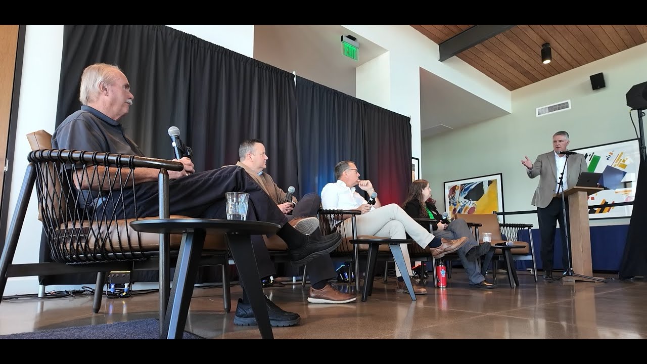
Prescott Valley pilots storm water infiltration technology, launches wildlife corridor planning initiative
Prescott Valley town leadership convenes regional experts to address water security through innovative storm water recharge projects and wildlife corridor preservation while balancing population growth.
Prescott Valley Launches Dual Initiatives to Combat Aquifer Depletion and Preserve Wildlife Habitat Amid Regional Growth
Prescott Valley's town leadership and a constellation of state, federal, and nonprofit experts gathered for a full-day conference to showcase two landmark initiatives: a biomimicry-based storm water infiltration pilot project designed to accelerate aquifer recharge in a groundwater-depleted region, and a comprehensive wildlife-corridor planning effort balancing conservation with inevitable population growth. The event, moderated by Hunter Moore (former Governor Doug Ducey's chief natural-resources policy advisor), centered on a collaborative problem-solving framework that explicitly acknowledged the region's water crisis—the Prescott Active Management Area has been out of safe yield since 1999, with aquifer levels dropping approximately one foot annually—while rejecting adversarial "water wars" in favor of science-driven, site-by-site evaluations.
Key Speeches
"Our work is never truly done. Stewardship of our natural resources is not a box to be checked, but a responsibility handed down from one generation to the next. The choices we make today ripple forward into the lives of our children and our grandchildren." — Mayor Kell Palguta, opening remarks
"Storm water has been treated as a nuisance, as a threat to public safety and to property. And so all the standards to date are designed to get water off the property or off the land as quickly as possible... We're trying to go from the concept of storm water as a nuisance to storm water as a missed opportunity." — Hunter Moore, moderator
"Nobody wins if everyone is short on water, right?... I feel really good about the relationship that Prescott Valley has been able to establish and maintain with SRP... We don't want to intrude on someone else's rights." — Tracy Lund, town water resources adviser
"I think the uniqueness of this project is really kind of the approach that we're taking to doing this. It's a collaborative effort. It's letting the science guide where we go and doing it in a controlled environment where we can evaluate the technology by itself and independently of any other conversation that's going on." — Lucas Shaw, SRP director of water rights and contracts
"I would hope that by demonstrating what's going on in both unenhanced enhanced basins and both of these test cases that we can open some eyes that we need to take a different look on how we're engineering storm water disposal basins so that it could be beneficial use... in the future." — Don Clark, Terracon Consultants, closing remarks
Panel One: Storm Water Recharge and Aquifer Recovery
The Red Rock Project
Ricardo Agari, director of land management and water security at West Consultants, introduced the Red Rock demonstration site as an independent engineering study testing technology developed by a company called Parana—described as biomimicry that mimics tree roots to accelerate deep percolation of surface water. The two-phase field trial, funded by a WIFIA (Water Infrastructure Finance and Improving Act) grant approved in 2024, consists of two 50-by-50-foot basins (bottom dimensions; approximately 82-by-82 feet at top, roughly 4 feet deep) separated by about 600 feet. The northernmost basin serves as a control; the southernmost employs the enhanced infiltration technology.
Rather than rely on Arizona's erratic rainfall, the team is pumping groundwater into the basins to simulate storm events, taking 90 minutes to 2 hours to fill. Water is then monitored as it infiltrates. SRP donated and installed a weather station to track evaporation effects. Moisture sensors, installed as deep as 45 feet, record data every 15 minutes to measure how water travels through both the enhanced and unenhanced basins, validating a finite-element model Terracon developed independently to predict percolation and evaporation behavior.
The 22–26-month timeline is designed to verify whether the technology can meaningfully accelerate the movement of water below what engineers call the "depth to constant soil suction"—roughly 14 to 25 feet depending on geology—at which point infiltrated water will no longer be drawn back up and evaporated by Arizona's intense sun. Early soil studies conducted by Terracon revealed that Red Rock's soils have hydraulic conductivity 10 to 100 times greater than EPA standards for rural clay landfill liners, making it an ideal location to prove the concept. Prescott Valley's proposed second site, at Glassford Hill, contains even more impermeable (clay-rich) soils, which will stress-test the technology further.
The Prescott Valley "Sister" Project
Tracy Lund confirmed that design work for a companion field trial at the Ponghorn development in Prescott Valley is underway. The town has submitted a WIFIA grant application for this project and awaited a decision at a Wednesday meeting. If funded, Lund stated construction could begin within months, with two basins approximately 300 feet apart (one control, one enhanced) replicating the Red Rock methodology. The Ponghorn trial will verify whether the model's predictions hold in a different hydrogeological context and test the technology's viability for both municipal and agricultural applications.
The Water Rights Question: "Urban Enhanced Runoff"
A central tension—and the conference's most legally and politically delicate issue—involved whether these infiltration projects might encroach on water rights held by downstream users, particularly the Salt River Project (SRP). The panel introduced a new analytical framework called "urban enhanced runoff" to address this.
Ricardo Agari explained that traditional water rights are tied to how a watershed behaves under natural conditions. When land is developed, runoff patterns change—development increases peak flows and the total volume of water that reaches natural channels. Urban enhanced runoff is defined as the delta—the volume increase attributable solely to development. Using historical rain-gauge records from pre- and post-development conditions, the team calculated urban enhanced runoff volume in Prescott Valley and compared it to the required on-site storm water retention volume mandated by current regulations. Agari noted: "Urban enhanced runoff volume is routinely less than on-site storm water retention volume. But both volumes of water are available to be harvested and put into the aquifer."
Crucially, Don Clark and the panel emphasized a site-by-site evaluation: projects would only capture water that would otherwise evaporate, not water destined for natural channels (which belongs to SRP and other downstream appropriators). Lucas Shaw acknowledged this collaborative framework directly, noting that SRP initially resisted the legislative proposals because they conflicted with existing groundwater and active-management-area regulations, but the team's focus on science and a mantra of "water that is otherwise lost to evaporation" created common ground. Shaw stated: "We need to better understand the science behind it," and the collaborative group approach satisfied SRP's concerns about protecting existing water rights while permitting innovation.
Tracy Lund expressed confidence in the town's relationship with SRP: "I feel really good about the relationship that Prescott Valley has been able to establish and maintain with SRP... We don't want to intrude on someone else's rights."
The Evaporation Crisis
Don Clark, a consulting geotechnical engineer with Terracon, grounded the project in stark hydrology: studies dating to the 1960s (Bureau of Reclamation) reported that 95% of Arizona's annual rainfall is lost to evaporation. In Prescott Valley specifically, evaporation potential is twice the annual rainfall. Even water that infiltrates into retention basins—the standard tool for storm water management—is often drawn back to the surface and evaporated before reaching the aquifer, unless it is pushed deep enough. Clark emphasized the role of soil properties: plasticity, grain size, and hydraulic conductivity determine the critical depth at which soil suction no longer pulls water back upward. Get water below that threshold—often 17 to 25 feet—and it will percolate to the aquifer and stay there.
Safe Yield and Aquifer Depletion
Tracy Lund provided the regulatory and hydrological context. The Prescott AMA was declared out of safe yield in 1999 by the Arizona Department of Water Resources (ADWR). Safe yield, defined by the 1980 Groundwater Management Act, describes a state in which an aquifer is not being measurably depleted relative to demand. The Prescott AMA has been pumping faster than recharge occurs—depleting roughly one foot of aquifer depth per year. This triggers restrictions on further development buildout. Lund framed the project as a stewardship imperative: "My objective as a steward of the aquifer is to try to get water into the aquifer, right?... When you remove water from the aquifer, it's going to change the properties of the aquifer such that you try to get more water into the aquifer. You're not going to be able to do it. You're losing volume... to fill."
Legislative Catalysts and Collaboration
Hunter Moore traced the initiative's origin to conversations between Prescott Valley Town Manager Gilbert Davidson and state legislators. Bills proposed in the state legislature, though they did not advance substantively, created a conversation table. Moore noted: "The legislation gets ahead of the science sometimes... We said, maybe there's something here. Let's have a separate conversation about what this bill is trying to accomplish." That conversation brought SRP, ADWR, West Consultants, Terracon, and the town together. The mantra emerged: focus on water that would otherwise be lost to evaporation, let science guide implementation, and defer major policy changes until data is in hand.
Ricardo Agari added a personal note: when his son was born approximately 15 years ago, he reconsidered the three tools he was taught as a drainage engineer—pipe, channel, hole—and realized he'd been trained to "dispose of" storm water rather than treat it as an asset. The Red Rock project and the broader initiative reflect his effort to "reinvent myself and... probably my profession," aligning with nature-based solutions and long-term water security for his generation and beyond.
Panel Two: Wildlife Corridors and Sustainable Growth
The second panel addressed how to preserve habitat and wildlife connectivity while accommodating population growth in a region experiencing significant development pressure. The moderator, Vinnie Goos, executive director of SIMPO (Central Yavapai Metropolitan Planning Organization), emphasized that SIMPO covers all Yavapai County except the Verde Valley and noted that the organization is launching a year-long regional trails-planning initiative this month to inventory trail connectivity and walkability across the region.
The Wildlife Corridor Foundation Guide and Phase 2 Plan
Sandy Hoffman of Logan Simpson Design (Tempe office) outlined the Wildlife Corridor Foundation Guide, a completed first phase of work for Prescott Valley. The foundation guide conducted baseline data collection across existing conditions, policies (Yavapai County comprehensive plan, town of Prescott Valley general plan), regulatory frameworks, and an analysis of 34 wildlife-corridor case studies from across the western United States, narrowed to five in-depth analyses. The guide mapped existing development and open space, identified land ownership and management, and examined future buildout scenarios under the general plan.
Phase 2, the Wildlife Corridor Plan proper, is now entering the design and scoping stage. This phase will develop detailed implementation strategies and conservation tools. Hoffman emphasized the importance of collaboration: "Everyone in this room represents some part of... government entity... nonprofit... or public.... Each of you bring something to the table that is very important to be able to move forward with a proposed solution."
Habitat Loss, Fragmentation, and Connectivity
Jeff Gagman, a wildlife biologist with the Arizona Game and Fish Department (28 years of service, focus on wildlife connectivity and vehicle-collision mitigation), articulated the core biological challenge. Wildlife face two threats: habitat loss (conversion of occupied habitat to other uses, forcing animals to relocate from optimal habitat to marginal areas) and habitat fragmentation (roads, development, and other barriers that sever movement corridors between habitat blocks, eventually isolating populations until they decline and become unviable).
Gagman illustrated the stakes with an example from Phoenix: mountain ranges once home to deer and other wildlife are now largely void of them due to habitat loss and fragmentation. He emphasized the regional scale: "Wildlife habitats, ecosystems don't know boundaries. They don't... well, Jeff will tell you they know roadways." He cited a finding that pronghorn antelope will not cross roads with traffic volumes exceeding 5,000 average daily trips (AADT). Wildlife corridors must be designed at a landscape scale, not bounded by municipal or county lines.
Challenges: Time, Money, Collaboration, and Perception
Gagman identified three primary challenges: time (available resources and habitat are diminishing; action must be taken now), money (corridors and habitat preservation carry real costs, both for infrastructure and for developers), and collaboration (unless all jurisdictions and landowners along a corridor address wildlife needs, the effectiveness of any single protection is negated).
Kim Shanik, water program director for The Nature Conservancy (based in Chino Valley), added perception as a fourth barrier. She noted that many newcomers to the Prescott area envision a "rural community" lifestyle but fail to recognize that the region is no longer truly rural—Walmart locations are within 25 minutes; the character has shifted dramatically over the 16 years she has lived there. This perception gap creates resistance to infill development and higher-density planning, which paradoxically are the most effective tools for preserving open space and wildlife habitat.
Shanik also raised the challenge of maintaining corridors over time. Ranchlands are often assumed to be ranches in perpetuity, but ranching is not universally profitable; market and generational pressures threaten to convert ranches to residential subdivision unless planning and zoning regulations actively preserve open-space outcomes.
Water and Wildlife Connectivity
Shanik highlighted a critical nexus: wildlife corridors depend on water availability. "You can only go so far in between water sources," she explained. Thus, the water-recharge and wildlife-corridor initiatives, though addressed in separate panels, are deeply interconnected. She also noted the recent completion of a Verde River watershed report card (2020, to be updated September–October 2024) documenting affordability and density pressures: high-density, planned-area development, while sometimes perceived negatively by residents seeking rural character, is often the most wildlife-friendly approach, as it concentrates people in fewer acres, preserving habitat elsewhere.
Strategies: Conservation Easements, Planning Tools, and Regional Coordination
Shanik discussed conservation easements as a tool: permanent restrictions removing development rights from land while allowing compatible uses (e.g., ranching or farming) to continue. She cited the Wells Ranch, which holds a conservation easement and will remain ranchland in perpetuity, providing habitat and riparian protection along the Verde River. However, she emphasized that easements are expensive and must be applied thoughtfully to high-priority habitat, not as a blanket solution.
She also advocated for planning-and-zoning solutions: review county plans (she praised the Yavapai County comprehensive plan), encourage infill and planned-area development over sprawl, consider light-pollution impacts on nocturnal wildlife, and leverage public lands (Prescott National Forest, Arizona Game and Fish Upper Verde Wildlife Management Area, and the nascent Del Rio Springs Headquarters Ranch State Park) as anchors for larger habitat networks.
Sandy Hoffman elaborated on existing-conditions mapping and stakeholder engagement: the foundation guide included listening sessions, focus groups, workshops, and a public event (featuring live animals—a skunk, ferrets, tortoise, and snake from the Prescott Zoo—to educate children about wildlife). She noted that even the Arizona State Land Department (not traditionally aligned with conservation) participated and confirmed openness to corridors and habitat protection, provided density targets were met. The lesson: dense, planned development near services can coexist with regional open-space conservation.
Regional Scope: SIMPO's Trails Plan Launch
Vinnie Goos announced that SIMPO is launching its regional trails plan this month, with Amanda Hart as project manager. Over the next year, the organization will inventory existing trail connectivity and walkability across Yavapai County (excluding Verde Valley) and solicit stakeholder input to establish a shared vision for a regionally integrated trail network. Goos stressed that trails, like wildlife corridors, transcend municipal boundaries: "A trail doesn't just stop at a town boundary. It goes throughout the region, much like this wildlife conversation."
He also noted that Yavapai County supervisors and county staff have recently committed to more active participation in these conversations, signaling a shift toward county-level coordination on open-space and wildlife planning.
Why Balance Matters: Future Generations
Both Jeff Gagman and John Jacobson (principal planner for Prescott Valley Development Services) anchored their remarks in intergenerational stewardship. Gagman quoted Arizona Game and Fish Department's mission: "future generations." Jacobson spoke of leaving a legacy, asking city and town leaders to avoid "tunnel vision" whether on conservation or development, and to remember that "these policies are living documents. We're always re-evaluating. We're always looking to see how to improve."
John Jacobson emphasized the town's role as facilitator and project manager: identifying priorities and needs, scoping budgets, investigating grants, contracting with consultants, and coordinating across departments. He cautioned against the default answer "that's how we've always done it," saying his team removes anyone from the room who offers that response. The goal is innovation and efficiency in balancing conservation, development, and water stewardship—not routine compliance.
Project Details
Red Rock Project
- Applicant / Proponent: West Consultants (Ricardo Agari, director), in partnership with Terracon Consultants (Don Clark, senior principal)
- Technology: Parana infiltration system (biomimicry-based, mimics tree-root function)
- Funding: WIFIA grant (approved 2024)
- Timeline: 22–26 months
- Location: Red Rock, Arizona (demonstration site)
- Design: Two 50×50-foot basins (bottom), ~82×82 feet at top, ~4 feet deep, 600 feet apart
- Control basin (north)
- Enhanced basin (south) with Parana technology
- Monitoring: Groundwater pumped into basins; infiltration rates, moisture sensors (to 45 feet depth), evaporation effects tracked via SRP weather station; 15-minute data intervals
- Status: Installation completed; data collection underway
Prescott Valley "Ponghorn" Project
- Applicant / Proponent: Town of Prescott Valley, with Tracy Lund (water resources adviser), Ricardo Agari, and consulting team
- Location: Ponghorn development, Prescott Valley
- Funding: WIFIA grant application pending decision (Wednesday meeting, per transcript)
- Design: Two basins (~300 feet apart), control and enhanced
- Status: Design work underway; awaiting grant approval; construction could begin within months if funded
- Purpose: Sister trial to Red Rock; verification under different hydrogeological conditions; test municipal and agricultural viability
Wildlife Corridor Foundation Guide & Plan
- Consultant: Logan Simpson Design (Sandy Hoffman, project manager)
- Phase 1 (Completed): Foundation Guide
- Baseline data collection
- Analysis of 34 western U.S. wildlife-corridor case studies, narrowed to 5 in-depth analyses
- Existing-conditions mapping (development, open space, land ownership/management)
- Review of Yavapai County comprehensive plan and Prescott Valley general plan
- Stakeholder engagement: listening sessions, focus groups, community event
- Phase 2 (In Progress): Wildlife Corridor Plan proper
- Implementation strategies
- Conservation tools (conservation easements, planning-and-zoning adjustments, etc.)
- Scoping underway; design phase commencing
- Key Collaborators: Arizona Game and Fish Department (Jeff Gagman), The Nature Conservancy (Kim Shanik), SIMPO (Vinnie Goos), Yavapai County, Arizona State Land Department
SIMPO Regional Trails Plan
- Organization: Central Yavapai Metropolitan Planning Organization (SIMPO), Executive Director Vinnie Goos
- Project Manager: Amanda Hart
- Geographic Scope: Yavapai County (excluding Verde Valley)
- Timeline: Launches this month; one-year study
- Purpose: Inventory trail connectivity and walkability; establish shared vision for regional integration
- Status: Kickoff underway; stakeholder engagement throughout 2024
Vote Breakdown
Not applicable. This was a conference/workshop format, not a legislative or zoning meeting. No votes were taken. The two WIFIA grant decisions (Red Rock already approved; Ponghorn pending Wednesday) are administrative federal/state decisions, not local votes.
Outcome & Next Steps
Immediate:
- Red Rock Project data collection proceeding on 22–26-month timeline.
- Ponghorn Project WIFIA grant decision expected Wednesday; if approved, design and construction to proceed within months.
- Wildlife Corridor Plan Phase 2 scoping and design launching.
- SIMPO regional trails plan kicking off this month with one-year stakeholder-engagement timeline.
Medium-term:
- Data from Red Rock field trial (22–26 months) will inform policy and modeling refinements.
- Ponghorn trial results (pending approval) will validate technology under different soil/hydrogeological conditions.
- Wildlife Corridor Plan will present detailed implementation strategies by end of Phase 2 (timeline not stated but presumed 12–18 months).
- SIMPO trails inventory and vision-setting process to conclude within one year, informing county and municipal planning.
Policy implications:
- Red Rock and Ponghorn data will inform future Arizona groundwater and storm water policy; panelists noted that current standards treat storm water as a nuisance to be disposed of quickly, not as an asset.
- Wildlife corridor findings and tools will inform Prescott Valley and Yavapai County land-use policy, planning, and zoning.
- Regional trails plan may lead to inter-jurisdictional coordination on trail connectivity and funding.
Continuance / Further Engagement:
- Hunter Moore and the water panel noted that policy conversations will follow, once science is solid.
- John Jacobson and the wildlife panel emphasized that Phase 2 will translate data and case-study analysis into actionable implementation strategies, with continued stakeholder input.
- Vinnie Goos encouraged all attendees to participate in SIMPO's trails-planning process and to "help author" the regional vision.
Controversies & Context
Safe Yield Crisis and Development Restrictions
The Prescott AMA was declared out of safe yield in 1999, triggering restrictions on development buildout that have been in effect for 25 years. The aquifer is being depleted at approximately one foot per year. This regulatory backdrop creates ongoing tension between growth aspirations and water sustainability. The storm water infiltration initiative is explicitly framed as a response to this crisis: if the region cannot access new external water sources (Central Arizona Project allocations, for example, are not available to Prescott Valley), it must recharge local aquifers through innovation.
Water Rights and Downstream Impacts
The most contentious issue addressed—though resolved collaboratively—was the risk that local infiltration projects might encroach on appropriated water rights held by downstream users, particularly SRP. Early legislative proposals were viewed skeptically by SRP because they appeared to disregard existing groundwater and active-management-area regulations. The panel's introduction of "urban enhanced runoff" as a limiting principle (only capturing water that would otherwise evaporate, not water destined for natural channels) and the commitment to site-by-site evaluation resolved this tension. Lucas Shaw (SRP) committed financial support and stated that SRP benefits from aquifer recharge in the region. However, the framework remains novel and will require careful validation as projects proceed.
Growth vs. Conservation Perception
The wildlife-corridor panel identified a cultural tension: newcomers and residents often envision rural, low-density lifestyle but fail to recognize that infill and higher-density, planned-area development are the most effective tools for preserving open space and habitat. Sandy Hoffman and Kim Shanik noted that education and stakeholder engagement are critical to building consensus for land-use policies that concentrate development near services and utilities, leaving larger areas open for wildlife and recreation.
Regional Coordination Challenges
Jeff Gagman and Kim Shanik both emphasized that wildlife, water, and trail corridors transcend municipal and county boundaries. A fragmented approach—each jurisdiction protecting its own parcel—will fail. The conference sought to establish a framework for "regional coordination, local implementation." The announcement that Yavapai County supervisors are committing to more active participation signals movement toward county-level alignment, but full regional coordination (including state lands, Game and Fish property, private ranches, and adjacent counties) remains a work in progress.
Analysis Paralysis vs. Action
Ricardo Agari noted tension between the scientific rigor required to justify policy changes and the urgency of the aquifer crisis. He expressed hope that the team will "demonstrate a level of prudence and wisdom to know that we've collected enough data to move forward and we don't get stuck in analysis paralysis." Don Clark and Lucas Shaw echoed this: the science must be sound, but at some point decisions must be made and implementation begun.
Duration
- Panel 1 (Water/Storm Water Recharge): Approximately 75–90 minutes (opening remarks, five panelists, moderated discussion, closing remarks)
- Panel 2 (Wildlife Corridors & Open Space): Approximately 65–75 minutes (five panelists, moderated discussion, closing remarks)
- Total Meeting: Approximately 3.5–4 hours (including breaks, transitions, and networking)
Exact duration was not stated in the transcript; these estimates are derived from the pacing and depth of discussion.
Other Notable Items
SIMPO Staff Recognition: Vinnie Goos introduced his team—Bin, Amanda Hart, Jesse, and Tyler—and invited attendees to engage with them on the regional trails plan and transportation-planning priorities.
County-Level Alignment: Mory Thompson, representing Yavapai County, was noted to be present. The county board of supervisors and county manager have recently committed to more active participation in open-space and wildlife-corridor conversations, suggesting a shift toward county-level coordination on these regional issues.
Nature Conservancy / Wells Ranch Example: Kim Shanik highlighted the Wells Ranch conservation easement (north of Chino Valley, between Del Rio Springs and the Verde River) as a model for permanent open-space and riparian habitat protection while maintaining ranching operations.
Del Rio Springs Headquarters Ranch State Park: Shanik mentioned this nascent state park project north of Chino Valley, which will eventually connect via the Peine Trail and public lands to larger habitat networks and the Verde River system, exemplifying landscape-scale connectivity planning.
View source transcript ▼
Source: [Archived] Water, Land, and Wildlife Event — April 16, 2026. Auto-generated YouTube transcript; may contain transcription errors.
And now I have the distinct privilege to introduce the mayor Kell Palguta who will be delivering our opening remarks today. Mayor was elected in 2018 after serving as Prescott Valley Police Officer for nearly 16 years. He currently sits as on the executive board of Boys and Girls club of Northern Arizona and was elected as Mayor of Prescott Valley in 2022. He continues to serve the community in many ways. So, please welcome Mayor Palguta. [Applause] Good morning everyone.
Thank you all for being here today and more importantly, thank you for the work that you guys do every single day to protect and secure Arizona's most precious resource. As public servants, scientists, engineers, and policy leaders, we know this truth well. Our work is never truly done. Stewardship of our natural resources is not a box to be checked, but a responsibility handed down from one generation to the next.
The choices we make today ripple forward into the lives of our children and our grandchildren. And that's why our presence here matters. I hope that we represent the best of what it means to meet our challenges here in Prescott Valley and as well all around the state. With data, creativity, and commitment, we live in a world that often rewards short-term thinking. We need to choose the more difficult path, one rooted in innovation, long-term planning and proactive problem solving.
There is no easy route to water security or land and wildlife management in a desert state. But there is a correct one and it lies in collaboration, courage, and the persistent belief that we can shape a resilient future through the strength of our ideas and the integrity of our actions. So on behalf of Prescott Valley and the communities that you serve, thank you for being part of that mission. We are proud to stand with you in this adventure.
To begin today's event, I would like to invite Hunter Moore and the panelists who will be part of our first presentation to the stage. And while they come up, let me introduce Hunter. Hunter is part of our Prescott Valley team and helped us to work with some of our most important field friends at the legislature. Arizona Department of Water Resources, Salt River Project, and surrounding communities.
He brings nearly 20 years of public policy experience in municipal, county, state, and federal government, and most recently served for 5 years as Governor Doug Ducey's number one policy leader in natural resources. In his work, he has negotiated on the management of the Colorado River, tribal water settlements, groundwater policy, energy, and other topics.
Our town manager, Gilbert Davidson and Hunter, have brought a group of experts together to explore what we think is a missed opportunity in water policy. And we are asking some of the most experienced yet forward-thinking thought leaders to look at our approach of harvesting water that would otherwise evaporate for the sole purpose of benefiting the local aquifer.
You see, every year, storm events deliver large amounts of moisture to us, but practically all of our water evaporates, leaving virtually no chance to become part of our aquifers. We have challenged ourselves to find ways to bring that missed opportunity to heal. But we were making it smooth as fast or as smooth as fast approach.
Instead of dreaming up the idea on paper and act and asking policy makers to make hard decisions, we are testing our ideas in real world situations and trying to learn what really makes sense and can really work for everyone.
So our panel of distinguished experts is going to walk you through the reasons that this idea is important to the concept of safe yield and the missed opportunity that storm water presents the conceptual framework of our project and legal rights that we are committed to respect and things that we have not yet solved. I invite you to consider this initiative in the true spirit of what it is just an idea. So thank you everyone. [Applause] Good morning everyone.
My name is Hunter Moore and it's a pleasure to be with you. This is a terrific venue and thanks to Green Living magazine and to the town of Prescott Valley and all the sponsors for organizing such a great event. And thank you to you for being here to learn and to be part of this this conversation and to learn about the things that are happening here in the Prescott Valley area. Before we before we begin the questions, I want to turn to our panel members and ask them to introduce themselves.
Not only some of their professional background, but the context in which their expertise matters for for this conversation around storm storm water. So I'll start to my right with Tracy Lund and then move over to Ricardo Aguirri, followed by Lucas Shaw with SRP and then Don Clark with Terracon. Hello everyone. I'm Tracy Lund. I am the Water Resources Adviser for the Town and I'm delighted to be here. So a little bit about my background. I am an ASU grad and um yes, thank you. Thank you.
Uh and I am from Minnesota originally. So, uh, I graduated during the recession and had to move back to Minnesota, but really was dying to get back to Arizona just because, uh, well, it's Arizona. Come on. Uh, so yeah, my background is in basically, uh, water chemistry uh, educationally, but kind of stumbled into hydro geology and a little bit of groundwater flow modeling, which I despised.
But um this basically uh I see this job as kind of the culmination of all of my educational experiences and all of the uh the uh all of my interests really because uh I I do a huge amount of outreach and love to talk to folks about just nerd out over this water situation here. Uh we've got a lot a lot to talk about, a lot to address with with hopefully innovative new approaches to uh to try to address uh safe field here in the Prescott Valley area. Thanks, Tracy.
Ricardo, would you introduce yourself, please? My name is Ricardo Aguirre. I'm the Director of land management and water security at West Consultants. The reason I'm here actually is because of a dramatic event that happened to me almost 15 years ago. And that was the birth of my son. And in that moment, I didn't realize it wasn't about me anymore. It was about him, his generation, and beyond.
And so I started looking at what I was taught in school, graduate school, undergrad, and realized that I was only given three tools as a drainage engineer. A pipe, a channel, and a hole in the ground. and that I was taught to centralize this resource of storm water and dispose of it.
And in that moment though of his birth, I projected a conversation, imagine a conversation with him in the future where he asked me about 12 to 15 years in the future, as a civil engineer, did you know the environment was degrading and were you in a position to do something about it? And I didn't want that answer to be yes, I knew and no, I didn't do anything about it. So in that moment I started to embark on this change of reinventing myself and largely probably my profession.
Uh which led to again being here today looking at water the way nature does decentralizing the resource of water treating it like an asset and making sure that that resource is can be available for uh for him his generation and beyond.
So more specifically you know we looking looking to partner with nature things like nature-based solutions uh engineering with nature is another term so this is the focus that I have and have brought been brought on at West Consultants to develop a land management service line that is resolutely focused on long-term water security and so things like restoring watershed function uh mitigating symptoms of desertification and certainly declining water tables and what we can do to uh address uh safe yield issues.
And so that's that's largely uh my introduction. I went to UVA and Illinois for whatever that's worth. Okay, we've got we've got one ASU one U of A and I think NAU is up next. Lucas Shaw. Hold on. Oh, there we go. Yeah, my my name is Lucas Shaw. Um and I am a uh NAU grad. So, so far we've got Okay. Three. All of our institutions are represented just about. So, yeah. My name is Lucas Shaw. I work for the Salt River Project. I'm the director of water rights and contracts there at SRP.
Um, I've worked for SRP for about 16 years. Um, most of those on the water side of of the company and and again, most of those in water rights uh related uh issues. Um, I, uh, work with several communities around the state to work on water challenges. Um, if you can't tell, there's a lot of passion here about, uh, water resources. And, um, that's true.
You'll find that throughout the water industry is that when people um, uh, get into it, they really want to not only share the the knowledge of what they know, but also share ideas and solutions. And that's what I've really tried to do throughout my career.
Uh I work a lot with uh municipalities and tribal communities right now and really um try and uh listen to the needs of those communities and find ways to address uh those needs in a way that protects SRP and our interests as well as uh meet the needs of others. So that's it. Thank you, Lucas. Mr. Clark. Uh good morning everybody. My name is Don Clark and I am a senior principal with Terracon Consultants in Phoenix in our Phoenix office and I'm a consulting geotechnical engineer.
So some of you might not know what geotechnical engineering is but that is a fancy term for soil engineering. And so I deal with uh soils and projects. And as you can imagine, any kind of project that is being uh undertaken by man has to do with being supported somehow on the earth. And so we're involved in several projects including water projects.
And part of my background is to determine how water flows through the ground and gets into the ground and what kind of damage that it can cause and what kind of benefit it could be. So um Ricardo and I teamed up about 20 years ago uh on water projects and uh we've had this in joint interest in uh how we can do things better as engineers and and benefit mankind for the future as well. So anyway, that's a little bit of my background, Hunter. Right. And I'm not an Arizona graduate.
I graduated from the University of Colorado. All right. Go Buffs. Our our friends to the North. Um, I'm going to try to work with this panel and tease out a lot of the details that were teed up by the mayor a few minutes ago. The mayor did a fantastic job of really articulating the idea of stewardship, hard work, and going at an idea with great people and great teams. And Ben teased that out as well.
Um today we're going to talk about the problem we're trying to solve, the opportunity that we want to explore, the technical factors that are important, the legal rights that we have to respect, and what's happening on the ground right now and what we're trying to put on the ground in the future. So to begin with the end in mind, our story today is about moving water underground faster to avoid evaporation and to reach the local aquifer quickly.
Uh we currently have a field trial set up in one part of Arizona to test an infiltration technology to determine its viability for recharge and we're working to set up a second project here in Prescott Valley. This team of people and a another network and group of folks that they all work with are leading those efforts. And we're going to talk to you today about the collaboration that is existing in in a really great great way.
And I'm going to go to Tracy first with with a question to really tee up the problem we're trying to solve. Tracy, in your introduction, you mentioned the term safe yield, and you you operate a municipal system here inside of an active management area, uh, which is part of Arizona's groundwater, uh, code, and and you have a responsibility to try to meet the concept of safe yield.
Can you speak about the challenges of drought and what safe yield means to a community like the town of Prescott Valley? So essentially safe yield is uh for those of you who are not in the know it's a a a policy construct that was put into place with the 1980 uh groundwater management act uh essentially defining a state wherein an aquifer is not being uh measurably depleted uh relative to uh the demands that are being being put on it uh by pumping.
So uh in 1999 uh it the Arizona Department of Water Resources, I'm just going to tell you I'm going to call it ADWR. So I just wanted to make sure that we've got acronyms uh laid out here, but ADWR declared uh the Prescott Active Management Area, which we are in, uh to be out of safe yield. And that put into place a number of things including uh some uh restrictions on further build out uh within the active management area uh and and we've been working under those auspices ever since.
So essentially uh the aquifer is being depleted at about uh a foot a year approximately um on average throughout the active management area. We as uh folks that live within the active management area, my my objective as a steward of the aquifer is to try to get water into the aquifer, right? Try to try to uh stop the draining, if you will, um of the aquifer.
Uh that's important because as you remove water from the aquifer, it's going to change the uh the the properties of the aquifer such that you try to get more try to get that same amount of water into the aquifer. You're not going to be able to do it. Uh it's you're you're losing volume to be able to void volume to be able to fill. Um, I don't know if I'm I'm wandering off course here, but I just wanted to, you know, like define what we're talking about with safe field.
So, with with that challenge and looking for opportunities, let's talk about storm water as a potential opportunity. Um, Ricardo, you you came into the the town of Prescott Valley's picture to help with storm water mitigation. Can you talk a little bit about what it the the the idea of storm water in a community like this and what is the traditional way to handle storm water? Yeah. So, traditionally a developer's engineer needs to deal with two things.
On-site storm water management on-site being on-site of the development as well as off-site storm water management. On-site storm water management basically in Arizona is through retention retention basins and those basins need to be sized to handle the 100-year 2-hour event.
Off-site storm water management is essentially allowing uh off-site storm water to flow through the development and make sure that there's no adverse flooding effects in accordance with the local flood plane administrator who is adhering to FEMA's national flood insurance program. And a follow-up question is has has storm water traditionally been treated as an asset, as a nuisance, as a an opportunity? What are what are some of the ways that storm water has traditionally been viewed?
Storm water has been treated as a nuisance, as a threat to public safety and to property. And so all the standards to date are designed to get water off the property or off the land as quickly as possible. So for for all of you, the main idea here is we're trying to go from the concept of storm water as a nuisance to storm water as a missed opportunity.
And for this group, infrastructure becomes a really important part of that conversation with flood mitigation, with the other tools and assets that you have. I want to go to finding the the opportunity and kind of coming together really u is focused in a story that happened about two and a half years ago as Ricardo was working to help the town of Prescott Valley with their storm water management plan.
There was a conversation that was started by the town manager, Gilbert Davidson, internally and he said, "If this is a missed opportunity, how do we have a conversation about it here in Prescott Valley, but also around the state? Who can we talk to? How can we work on the idea that this might be a way to capture an an opportunity?" in trying to figure that out um and trying to create a table where we could have a conversation.
Um the legislature was in session and there was a bill that a series of bills that had were introduced that essentially created the table for us and that opportunity turned into a conversation. the bills did not progress to any measurable degree, but like most opportunities that the legislature started a conversation between these parties. Um, Lucas, can you kind of speak to the key pieces of how that conversation went and how it was an inviting opportunity for you? Yeah, sure.
Um so as sometimes happens at the legislature um the the legislation gets ahead of the science sometimes and that was the case in this uh scenario where um there was language proposed that um tended to step on the feet of other legislation that had already been passed um related to active management areas and um existing groundwater regulations that were already in place. So we said, well, okay, maybe there's something here.
Let's have a separate conversation about what is try this this bill is a trying to accomplish. And it was trying to do a good thing. It was saying, let's um take advantage of this opportunity, a missed opportunity to get uh storm water into the ground faster and to help aquifer conditions. So that was the intent. What we needed to do is better understand the science behind it.
And that's when uh we kind of established this uh group together and said you know what is some what is what what is the opportunity and we've kind of had a mantra that we've all been talking about which is um water that is otherwise lost to evaporation. So if we can do something with water that is otherwise lost to evaporation then there's an opportunity here. Let's see what we can do around that.
let's see what the science suggests and then follow that and then have a policy conversation later on. So I want to go to Don because Don's quite passionate about this missed opportunity. Don, can you talk about storm events and what what falls on the ground and then eventually what evaporates? Can you talk in generalities about the missed opportunity?
So, in general, if and there's been several studies about evaporation in Arizona, but I I'm going to I'm going to reference as early as the 1960's, uh the Bureau of Reclamation did a study and reported uh based upon their evaluation that 95% of the rainfall that falls on the state of Arizona is lost back out to evaporation right now. And um it it occurs I mean some water infiltrates into the ground, some of it used by plants, but it doesn't get very deep.
It runs off very fast and it 95% of it's lost. And uh from a from a soil engineering standpoint um this evaporation process uh uh here in Prescott Valley for example the evaporation potential is twice the amount of annual rainfall that we get. So that's the kind of potential evaporation losses that we're talking about.
The other lost opportunity is that there is some misconception and Ricardo sort of teed it up about how we manage storm water and flood events that uh we build these on-site retention basins. And I think that there's some misconception that boy that's doing good because we let that water infiltrate into the ground. But the other thing that you need to realize about evaporation is that that pole actually pulls water that's infiltrated into the ground unless we get it deep enough.
We're going to talk a little bit more about that, but uh that's that's the lost opportunity here is that we've got our great one of our great assets is sunshine, but it's really detrimental to this whole concept of getting water into the ground because of the evaporation potential. Any other comments on that before we move into what we're doing with the project?
I could just also add there's kind of more recent um studies that suggest that level that which you need to get water into the ground so it doesn't come back up and evaporate is um it can vary based on geologic conditions but we're talking in the order of like 17, 20, 25 feet. So you got to get it below that so it stays in the aquifer. So three years ago, the original ide the the original task was let's update Prescott Valley's storm water management plan. Ricardo comes on the scene.
The town, new town manager dealing with Tracy and and the team facing the idea of safe yield and growth and trying to be responsible stewards of water resources and a desire to have a conversation with some of the most important parties in the state and in this region. SRP being preeminent among those fostered by a legislative action brings us all together.
So then we start talking about how can we try to capture this missed opportunity and that's where the Red Rock project starts to come into focus. So, I want to turn to Ricardo and Tracy and talk about the location and the content of the idea around what we call the Red Rock project and how it was identified, some of the parameters of how the project's working and uh just kind of run with the idea of these people want to see if we can beat evaporation and how we're trying to do that.
I think let me let me piggyback a little bit on what Lucas was saying. Hunter brought me in to SRP in April of 2024 and I I did a comprehensive presentation of the litany of practices and treatments that I have acquired and become and have become a practitioner on on a demonstration site that West Consultants has in Red Rock.
The one thing that I recognized or I was asked from um the team at SRP that was apparent is that they zeroed in on this one technology, a technology by uh that was uh developed by a company named Parana. And the way I see it is that this technology is some form of a bio mimicry, mimicry that mimics tree roots.
And at that time we were also having conversations with the central Arizona Irrigation and drainage district and presented similar to Prescott Valley the potential merits that this technology could have in agriculture. And so the founder of Parana Don Clark and I were exploring ideas on what that could be. But then this group expanded or that group expanded into this group and it became more of a legitimate approach.
And so what we're doing in Red Rock is a true independent engineering study to contribute to the engineering community as a means of how we can deep accelerate the percolation of surface water. What we decided to do was pursue a WIFA grant last year and we were very fortunate because hold on just a second for for those who are not water buffalos, WIFA is the Water Infrastructure Finance Authority.
It's a state agency uh that was augmented with a a number of uh dollars several years ago that funds different types of projects for water augmentation research and savings. Keep going. Yeah, thanks Hunter. So, with Hunter's help, we were able to get this grant approved and funded, and it's it has a 22- 26-month uh timeline. Uh, and we just were installing the technology a week before last.
But what it is that we're wanting to do here is verify a model that actually Terracon took the initiative without me even asking them. And I was heartened to see and this was actually in the presentation to SRP in April. What this is is a finite element model that looked at what is occurring evaporation wise with these retention basins that are on private development. But then it also modeled this technology.
And what we began to realize is that there appears to be a potential here to deep accelerate the percolation of surface water in this case storm water. But the point is, and the pitch to WIFA was that this technology and what we're doing to deep accelerate this percolation of surface or storm water is does that it could have both municipal and agricultural applications.
And that's why Katie signed up with a nonprofit that I also run uh to pursue this grant and verify what this model uh was showing. One last thing before I cut off here that I had learned from Don was that when they did the geotechnical study, the boring analysis, I had learned from from Dawn that the the soils in Red Rock are 10 the minus 6 to 10 minus 7 in terms of imperviousness.
And that's a reference to what's called a hydraulic uh conductivity that is 10 to 100 times greater than EPA's requirement for a rural clay liner for a landfill. And the reason we want to do a project here in Prescott Valley is because because of uh the the the degraded basalt of Glassford Hill creates uh fatty clays and in some areas it could be 10 to the minus 8. So even more impervious than what's in red rock.
So we're really going to be putting this technology to the test and that's the the impetus and the purpose of the study. Really quickly, for those who haven't been to Red Rock or need a picture, can you def can you describe what the two different basins look like, what they are, how they're what they're set up for, and just an idea of what the experiment's going to look like? Sure.
So, because it rains so erratically in Arizona, we're using we're pumping groundwater to rapidly test two 50 by 50 foot basins. And those are bottom dimensions. The top dimensions because these basins are roughly 4 feet uh in in in depth are 82 by 82. The basins are about uh about 600 ft apart because we don't want them to in uh influence each other. Uh the northernmost basin is the control and the southernmost basin is the enhanced basin with these technologies.
So we have a we are pumping ground water into these basins. Takes about 90 minutes 2 hours to fill. And then we let it sit and see how fast the water infiltrates. SRP was kind enough to also donate and set up a weather station that's going to help us with the evaporation effects that Don was uh talking about earlier. Not only are we measuring the rate of drop in the ponds, but we've got moisture sensors in the ground.
And the point of those moisture sensors, we put them in as deep as 45 ft so that we can see how the water is actually traveling through the ground, how deep it gets in both the enhanced and unenhanced basins. And this will be used as part of our process to prove out our finite element model that we've already put together to show how the water goes in and out of the ground in both of these uh basins, the one that's the unenhanced and the enhanced basins.
So, we're not only measuring the water into the ponds, but we're looking at how that water gets into the ground as well and these moisture sensors that are a data driven process that I can't remember. We record information every 15 minutes or something like that. And so that will be used to uh again refine our modeling and find out how this process is going to work. Thank you. I want to turn to Lucas and ask the question aside from aside from the technology.
What's different about this particular process, this engagement than others that you've heard of or seen? You know, kind of talk to us about what what's the uniqueness of of what's happening here? I think the uniqueness of uh this project is really kind of the approach that we're taking to to doing this. So it's a collaborative effort.
Um it's um kind of letting the science guide uh where we go and and uh doing it kind of in a controlled environment where we can um evaluate the technology by itself and independently of any other conversation that's going on. Um I think sometimes where we see in in other areas, you know, uh uh storm water is um either seen as a nuisance to to to get it away or um it's, you know, wrapped up in a policy conversation where there hasn't been good science done to it.
So that's really where I think this is a unique project and helps us to um kind of uh evaluate uh the merits of uh of the technology as well as the opportunity and see what the opportunity is. I think we want to understand you know um how great of an opportunity uh is it if it's a small opportunity there's a lot of cost you know associated with it. If there's a big opportunity let's take advantage of it. Thank you. I want to go to Tracy.
And you can't have a water conversation without talking about whiskey and fighting. Um, it's the greatest cliche of all water buffalo conversations uh in the West in particular. But I want to turn to Tracy and I want to ask this question. It's a little bit facetious. Um, Tracy, is Prescott Valley trying to take anybody's water rights? No.
Uh, and that's actually one of the things that that I keep coming back to when I think about this whole project and our involvement with SRP is that uh I'm I feel really good about the relationship that Prescuit Valley has been able to establish and maintain with SRP. Um, because uh that has not always been the case. Um, and you know, I think and I and I I don't want to like put words in in Lucas's mouth, but I feel like this is probably uh a logical offshoot uh policy-wise at SRP.
Nobody wins if everyone is is short on water, right? And we in Prescott Valley are conscious of the fact that we don't want to intrude on someone else's rights. Um, uh, you know, the there's there's a hundred years or more of of of history here that we want to be able to be, um, very conscious of as we're trying to carve out this small bit of water that could make a real difference um, in uh, the the more remote areas of of Arizona.
All the water that is flowing to the north from here um uh during storm water flows, heavy storm water flows, the stuff that makes it to a final destination that isn't the atmosphere is actually going to the Verde River system. Um and you know that's SRP's water and we want to make sure that we are not actually encroaching on water rights downstream. So, can I add something else? Just please.
One of the interesting things that we've done in this project is to kind of ask the question, you know, does the water that's intended for any of these projects hit a natural channel? That's kind of a key term because that's what separates what's uh surface water and is um already appropriated by folks like SRP and what is eligible for um local aquifer recharge. So that's kind of a key question. So it's a sight by sight um evaluation that has to be done.
Is this site does it hit a natural channel or not? And that's a question that's been asked and that's part of the collaboration that we've done. So with any so so let's get I I don't want to bore anybody or on a Friday put you to sleep, but let's talk about some math. Um and I I went to law school for a reason. It wasn't because I was great at math.
Um, I want to go to Ricardo and it's tied to the water right conversation, but it's also tied to how do we know that we're really getting to a missed opportunity and not somebody's water, right? So, I want to go to Ricardo first and ask you to talk about something that we are calling and this is a new term for for most of the folks that out there. It's we we are calling this urban enhanced runoff. I'll say it again, urban enhanced runoff.
And can you explain why we're trying to come up with math around that term and what it means for the project? Sure. So to piggy back off the slogan that Lucas shared, we're looking at water that would otherwise evaporate and to be able to harvest that and harvest it in a way where we're not affecting downstream water right holders such as SRP. Urban enhanced runoff looks at the watershed from a land use perspective.
So water right holders are entitled to the water rights that flow off a watershed under its natural conditions. When you develop that land, when you develop parts of the watershed, it begins to change the land use and therefore change how storm water uh runs off the land. it has the effect of increasing time to peak and the also the peak uh flows and engineers need to be able to manage that as I was saying earlier in order to um control flooding and treat water like a nuisance.
So what we're looking to do, what we've been looking to do and the team has been looking to do uh is figure out the volume of urban enhanced runoff which is basically the delta of volume the increased volume due to development. That's the probably the best way to to describe it. This was born out of project that I did in Cochise County uh downstream of Sierra Vista. It was the first approach that the team that I was on at that time were figuring out how to do it and I think it's come a long way.
And so we what we have done for the town with SRP lockup with us is come up with a simplified approach where we were looking at historic rain gauges of watershed natural conditions and comparing those conditions against developed conditions. And then not to get too deep into the math and geek out on you, it's just focusing on identifying that volume.
So we really wanted to do that to understand is is this volume greater or less than the volume for the required on-site storm water retention that we spoke about earlier on the panel discussion. And what we're finding out is that urban enhanced runoff volume is routinely less than on-site storm water retention volume. But both volumes of water are available to be harvested and uh to be put into the aquifer. Don, since we're trying to get more water into the ground, how can we measure that?
How does that what type of technology do can we use? What kind of u factors are important as we look at trying to get more water into the ground? What would what would be key in the the information that we start to gather? Well, there are several things from a again from a a soil engineering standpoint. Um we need to look at particularly with respect to these retention basins and and making better use of them. what the ground conditions are at each one of those locations.
And instead of just infiltration rates, we need to look at the hydraulic conductivity, how fast the water flows through those soils. We need to look at the soil suction characteristics. Not to get too technical, but we got all kinds of different soils in the state of Arizona. They all have different water retention characteristics and they they actually absorb water into them but then they release them through the process of evaporation.
And uh the the science behind this is that by knowing certain engineering properties of the soils, the uh plasticity characteristics, the grain size characteristics and the like, we can actually look at each one of these basins and determine what we soil engineers call the depth to constant soil suction. And that's what Lucas mentioned earlier. We know that that could be as great as 14 to 20 feet in the ground.
So if we're going to take advantage of um the the use of water storm runoff, we got to look more specifically at soil properties, do analysis to determine how deep we've got to get the water into the ground so it's not sucked back out in the atmosphere by evaporation and all the sunshine hitting it.
Uh and and if you don't think the that the sun sucks water out of the ground, you can just go to any dry lake bed and see all kinds of cracks and the like and that's water being sucked out of the ground. If that were down deep enough, it's not going to be sucked back out. And once we get the water into the ground deep enough, I can tell you from a fluid flow standpoint, it's going to continue to go on down to the aquifer. But we don't want it to be sucked back out.
So this evaporation process not only affects surface bodies of water, but it affects water that's in the soil as well. And we got to figure out how better to take advantage of that by designing and and engineering basins that are right now quite frankly just used for water disposal that are really not having any beneficial u effect in terms of recharge. Thank you. Um I'm going to start with Tracy.
We're doing work now in Red Rock and there's an effort to put another sister project uh what we're calling a um it's not a pilot but a field trial uh here in Prescott Valley. Can you talk a little bit about the process that we're that so we've done the design work and we've got an application in front of WIFA. WIFA was mentioned earlier. Can you just talk about what we're looking at in terms of a second project here in Prescott Valley? So it's obviously dependent greatly on the grant funding.
Uh we are actually on the docket for the next whiff meeting on Wednesday I believe uh to actually uh secure funding for that particular project. Um the design is just starting now I think for the Prescott Valley project if I remember right. Um and uh you know if if the money comes through then I think uh within the next few months we should be um starting in uh on the the project.
It's slated to be in the Ponghorn uh development and um the two basins we're going to be doing a similar setup with two basins about 300 feet apart if I remember right. Um, and so we'll have a control and uh an actual test basin. So, as a scientist, makes me happy. I'm doing actual science. It's kind of fun. So, yeah, we're looking forward to it. So, a fair point. Is this about science right now? Is this about policy right now? What is What is this about in It's science. It's science.
We want to make sure that this is a, you know, a good a good use of of the money because we would like to be able to set up more of these types of situations around the Prescott Valley area to get more water into the aquifer. Um, so this is kind of a we're doing a little R&D work here to see if this is a viable alternative to storm water uh issues here in the Prescott AMA. Terrific. So, I'm going to go to general wrap-up comments.
I'm going to start with Don, go to Tracy, Ricardo, and then because Lucas is our guest here from SRP in the town of Prescott Valley, I'm going to give you the last word if that's all right. So, just general thoughts on storm water, the work that we're doing, the need in Arizona. Please give us your your closing thoughts.
My my closing thought is that I hope it's my fervent hope by both the Red Rock project and the project that we may take here and undertake in Prescott Valley is that we can actually change policy in the future on how we look at storm water disposal because right now as a geotechnical engineer I can tell you having done analysis that we're we're not taking advantage of it.
So I would hope that by demonstrating what's going on in both unenhanced enhanced basins and both of these test cases that we can open some eyes that we need to take a different look on how we're engineering storm water disposal basins so that it could be beneficial put to beneficial use in the future. I would hope that policy would change from the science that we'll gain out of these two test programs.
I think this is just really exciting to be able to to try to innovate a new just moving forward trying to change the way we traditionally do things um because clearly at this point we need to alter our relationship with water fundamentally in the state of Arizona. Thank you Tracy Ricardo. In 2012, I became certified in water harvesting in Tucson from an outfit called Watershed Management Group. And I learned that some of the affluent areas in Tucson, the wells had already started to dry up.
That's the concern that's happening here in Prescott Valley. So for me, yes, science is the focus with the prelude to what Don was saying in in changing policy. So I think my concern is, my hope rather, is that the team is able to demonstrate a level of prudence and wisdom to know that we've collected enough data to move forward and we don't get stuck in analysis paralysis. And that's going to take some thought.
It's probably going to take a decision maker or some decision makers to say we've got a lot of data. we've got enough data or whatever you want to call it coming out of these two field trials, we probably should start moving forward because the clock is ticking. So, that's how that's kind of how I see things. I'm I'm on the fence. I want to I I want there to be clean science.
I want the CL science to be uh profound, but I also think that at some point we need to make some decisions to start making some changes too. and and and and so I I would be looking to leadership Gilbert um for you know making maybe making some decisions and and hopefully I didn't hope I didn't speak out of turn Lucas. No, I think we we want the same thing.
We want to see the science u behind it and know that um the benefit is being realized if if there is a benefit and um the worst case scenario would be to um to end up with what you think is happening to not have it happen and to not get the aquifer recharge that you think is happening. So that would be the worst case scenario. Best case scenario is you forecast, you think this is what we should see and you get even more. So that would be kind of the best case scenario.
Um we're committed to this project. Um you know, financially we've committed uh some funding should uh the town receive WIFA funding. So we're we're we're all in on um seeing where the science goes. And uh obviously we benefit, the river benefits uh from this type of science and the town will benefit um from having done it regardless of what the um what the outcome is. Ladies and gentlemen, we've reached our time.
I first want to say thank you for your attention and for being here to learn about what's happening in the town of Prescott Valley and the leadership that is uh really being taken on for a tough subject. Um, I also want to thank our our panel here. They've done a great job in explaining and working uh to get you the ideas. Following the meeting, we'll have a little bit of time. If you have a question that didn't get answered, please seek out our panelists.
They'll be happy to talk with you as the session wraps up. Let's give these folks a round of applause. [Applause] So panel two is Open Space Land Management and Wildlife Corridors and the moderator is Vince is Vinnie Gallegos and he's with CYMPO. Vinnie Gallegos, I'm going to turn over the mic to you. Hello. Um my name is Vinnie Gallegos. I'm the Executive Director of CYMPO and we'll help out with the acronyms today. So, Central Yavapai Metropolitan Planning Organization, a mouthful.
Um, if you're not familiar with our organization, we've been around for a little over the last 20 years. Government organization that's focused in the movement of people, goods, and services in a safe and efficient way. So, we focus on regional transportation planning. And it's my privilege to be up here with a a group of colleagues and experts in their own field. and I'm very honored to have been asked to be the facilitator of this session.
Just a brief background as to what CYMPO is working on is is as we look at our transportation system and we look at our highways, our significant roadways, bicycle, pedestrian, trails, public transit, again it's the movement of people, goods and services in our community. And you know, I I heard the word earlier today and I want to stick with that from the mayor and other presenters of stewardship. You know, that's something that really uh resonates with many of us, me in particular.
And I think um I have the fortune that my family settled in Prescott around 100 years ago and much of my family is still there to this day. And I look at, you know, the the growth and the development and all that's taken place. But in all those hundred years, I know something that's been very important to me and to my family before me is to be stewards. To be stewards of the resources that we're given. And that's really the the theme today.
And and how do we best steward the resources that we have? And as an organization, I'm very proud that we work I work with a a very great staff. And I I would ask my staff to to stand and give them a round of applause for their efforts, please. [Applause] So, if you haven't had a chance to meet them, Ben, Amanda, Jesse, and Tyler, I really encourage you to take some time to meet them because because again, as an organization, we're looking to be stewards of our community.
We're looking to have a conversation with you and figure out where does the infrastructure fit to the quality of life that we need and want in our area and where does it tie into this conversation. CYMPO understands that it's the infrastructure whether it's a bicycle path, a trail, a major highway or roadway ties directly into the greater environment and it goes directly into this wildlife conversation. So with that said, I'd like to give the opportunity for the panel to introduce themselves.
I'll start on my far left with Sandy and we'll work our way towards Jeff. What I'd like you to do is u name who you represent and and really where do you tie into this conversation today Sandy? All right. Good morning everyone. I'm Sandra Hoffman uh where I am from? I'm with Logan Simpson Design out of Tempe office. And what I've had the honor to do is to manage a project uh for Prescott Valley.
It's called the Wildlife Corridor Foundation Guide and it will be followed up hopefully with a wildlife plan. And so my involvement with Prescott Valley has been through that and also some help with the parks and rec department. Tying into the other uh panel members, I just I would like to let you know that I have uh a landscape architecture degree from U of A, but I have an environmental planning masters of environmental planning from ASU. So I can root for either team. Thanks, John.
No, you can't. Um John Jacobson, Principal Planner, uh development services, town of Prescott Valley. And my tie to this is being the project manager on the town side, working directly with our consultants with Sandy, their scientist, biologists really been eye opening and and you know, a wonderful experience. Uh I too have a degree in landscape architecture. So we have that in common. I went a little different route earlier in my career. Uh development consulting for almost three decades.
Uh grew up I'll do a little background Vinnie um because the first panel kind of laid it out there. Um from Maine originally, the great state of Maine and have been in the uh went directly to the valley uh Phoenix metro. Again, consulting master plan communities went through the housing boom and just learned a ton on the development side.
And that's what attracted me to make this transition to the public side and hopefully offer, you know, through a different lens and and be able to coordinate these types of things. Um, whether it's wildlife corridor or our day-to-day activities in development services. I mean, we talk about ASU, UVA, okay, but you know, it's Ohio State. Come on. So, thank you, Vinnie. Hi, I'm Kim Shanec with the Nature Conservancy. I actually live up in Chino Valley, so I see many of you in the Verde Valley.
I see you in Phoenix. Um, so it's actually quite exciting that you're all up here um in the neighborhood. So, thanks for for coming. Um, I also usually talk about water. I'm the water program director. I work statewide on a wide range of water issues. And it turns out that water and wildlife corridors are very linked and highly connected.
So, I'm excited today to be able to talk about wildlife and nature and maybe a little less on water infrastructure, although I do love talking about water infrastructure. We had a meeting last week and I think we talked about septic tanks a little too much. Um, so really excited to be able to think about wildlife and wildlife corridors and those places where we choose to protect for wildlife and provide those benefits can also have connected water benefits.
And so this is a really great thing that the Prescott Valley has pulled together here in thinking about both water, wildlife. How do they connect? How do we work together? How do we think about transportation in light of all of that? So that's me. My name is Jeff Gagnon. I work with Arizona Game and Fish Department. I've been there for a little over 28 years now. Uh a lot of focus of my career has been on uh wildlife connectivity and wildlife vehicle collision mitigation.
So when you see animals get on the hit on the road, I've been working a lot a lot with that kind of stuff and then connecting wildlife from point A to point B. Um I actually grew up here young young child. I grew up here in the late 70s, early 80s down here on Sunset Lane when there was only a couple car cars a day and there was a little school out in the middle of the field and and so there's a place in my heart for for Prescuit Valley area. I I live in Camp Verde now but so not too far away.
Um, I I went to school at NAU for my both my uh bachelor's and master's degrees. So, I forgot to do my school affiliation. So, I'm a Lumberjack. We're kind of like Switzerland when you get between Wildcats and Sun Devils. So, we're just steady in the background, Jeff and I. So, uh, NAU master's degree in public administration. My bachelor's is in psychology and, uh, community planning. Um, so we have about 50 minutes in total when we started for this session.
So we're going to spend some time asking some preset questions of the panel. I'm going to ask a question for two of them, move on to a next question, change it up a little bit, and then we're going to try and see if we can't have a little bit of time at the end for questions that you may have. So this first question, I'm going to focus on uh we'll start with John and then we'll go to Jeff on this first question.
Why should cities and towns, counties, balance the need for open space preservation with ongoing population growth and development demands? So, I'll start with John. We talked about this earlier. That's a softball because think about it. We are public servants. Okay? So, to that end, it's it's right in our wheelhouse uh to pay attention to these things and actively participate.
And so what I'm saying is is it's incumbent upon us public servants uh to take responsibility for these types of things. And when I say these types of things, whether it's conservation, development, um and again be stewards of each of those. And we don't see it as being binary. It's not conservation or development. Our goal is what you'd expect to have this harmony between the two.
And that's really our focus and and I think it's a real challenge for all involved um no matter where your interest lies to really buy into that and understand it and and we remind ourselves don't get me wrong we don't have this all figured out. Uh but if I take the question and put it specifically to development services uh at the town I mean think about our day-to-day um activities. We are compliance regulator.
I mean we we take in these development requests and applications and we measure them against our policies as simple as that sounds. Um but what when we get that tunnel vision what we lose is the knowledge that it's a living document. These policies are living documents. We're always re-evaluating. We're always looking to see how to improve. You heard from the water folks. same philosophy, same approach. These policies are not stagnant.
Um, so what you see in this case, specifically development services and this wildlife corridor that we've been working through, it's the same lens. It's how do we balance this? Yes. Today, this whole past year, um, consumed with this special project of the wildlife corridor, don't be misled that that's our only focus. This is the end result is what I stated to have this balance. So what we do is we identify these needs. We talk about the scope. We we talk about let's look long range.
What's the implementation strategy? These are all questions we have and that we walk through as part of this process. And we enlist specialists whether they're biologists or or water folks or the conservancy or game and fish. And we recognize as overall project managers and looking at all of the considerations and really make sure that we don't get um any sort of tunnel vision whether it's conservation or development that they all need to work in concert.
And that's really to answer the question that's really why we feel the need and why we're involved in this. And we'll talk a little bit more about how this plays out. Uh but that's really why public agencies need to identify these needs for conservation development and water and all the things that we consider circulation Vinnie mentioned. Um one example would be on this local conservation effort. Um and I would like to mention and that's why uh Vinnie's involved in here too.
One of the things we say is this is regionally coordinated and locally implemented. Uh so again I mean wildlife habitats ecosystems don't know boundaries. They they don't well Jeff will tell you they know roadways. I think Jeff enlightened us on pong horn in one of his talks last year that if a particular roadway has over 5,000 uh traffic count if you look at ADTS that pronghorn won't cross.
And of course, me trying to be funny, I would say, "Well, I didn't know pronghorn could count." But the point is, there are barriers, but they're not the town limits. They're not the county limits. They're not the state limits. So, there's a lot to unpack and a lot to consider, as you might imagine, working through these types of things.
And we love the challenge and we're looking forward to this coming year for the next phase of this wildlife corridor, which will result in the plan proper that you might envision. when we say wildlife corridor plan, you know, we go right to the end product. And that's where we're headed this year. Um, and that's why we see the importance and see the need for public agencies to really be at the forefront and drive these types of studies and plans. Thank you, John.
I'll go ahead and repeat the question, and this will be for Jeff. Why should cities, towns, counties balance the need for open space preservation with ongoing population growth and development demands? Jeff. Thanks, Vinnie. One of the things that um has come up multiple times is future generations. And and if you look at um Arizona Game and Fish Department's mission, that's that's the last two words of the mission is future generations.
And so, as um you know, developments happen, the the the decisions we make today will will affect those future generations. And one of the things that I want to touch on, I want to take a step back on and talk about um some of the impacts to wildlife and what needs to be balanced. For example, there's there's two real main things that happen. There's habitat loss.
So, if you have an area where where wildlife are living and you turn that into something else, that's one less place that they have to live. They have to move on to somewhere else. They're usually living in their ideal location, but then they're pushed out to other areas as more of their area is taken over.
And then there's the habitat fragmentation side which John alluded to with the traffic volume but that happens with development of any kind or or energy or whatever it may be that can what things can happen to where those animals can't get from point A to point B for increased survival. And you start to get to a point where if those animals are completely cut off from um opportunities to survive then they become a less viable population and they'll start to decline and eventually can fizzle out.
And so keeping the balance of of the habitat and the connectivity between those habitats um intact is going to lead or lead to a longer term solution. And and you know in some in some areas if you go into Phoenix you see areas where there's mountain ranges in the middle of the town. Those used to have have deer in them, different animals in them. Some of those are void of that now. So here in Prescott Valley and the surrounding areas, you've got to still have a lot of opportunities.
And so it's it's neat to see that there's this forethought to be able to to try to address and uh and and make this balance that John was talking about before because population growth is going to happen, but there are smart ways to do it from a quality of life perspective for our future generations. Thank you, Jeff. I'm going to go to question two and we'll go to Kim and then we'll come back to Jeff on this one.
Kim, what are the main challenges to establishing and maintaining effective wildlife corridors in our region and how can they be overcome? I'm actually going to let Jeff start because he's the expert. Sure. So, the question again, main challenges establishing wildlife and maintaining wildlife corridors in our region and how can they be overcome? So, some of the things I came up with was time, money, and collaboration. So, from a time perspective, it's kind of like what I just talked about.
there's there's available resources for wildlife corridors and the habitats that that can be connected, but they go away quickly. Um, a lot of them are planned to go away. Um, and so being able to do something now is is important because it's just going to continue to um there there'll be areas where it's going to continue to uh, you know, remove wildlife or block wildlife. And so taking what you have have to work with and making some of these decisions now can help that that down the line.
Um, from the money side of things, there's there's a cost for corridors and habitat, whether it's building a wildlife crossing or establishing a corridor or even the cost to uh developers for not establishing or for not building in areas where there's a wildlife corridor. And one of the things to think about is it's hard to put a value on that quality of life and and the future generations enjoying the wildlife around us.
So trying to think think about that and it seems like um a lot of folks in this room kind of kind of think that way. So it's a positive direction to go. So just keeping those in mind. There's and there's ways to overcome some of the things like funding sources. is there's you know examples are like uh in Pima County they have a regional transportation authority of Pima County where they were able to raise raise funds for wildlife corridors and stuff like that.
So that's I won't get too too much into the weeds on that unless anybody asks about it but um examples on how that can be be discussed and then collaboration is a really big one. So what we what we see is um areas where different land owners or jurisdictions or whatever it may be if they're adjacent to each other. And let's I'll give an example.
Let's say there's one jurisdiction has a habitat block that wildlife live in uh one landowner or jurisdiction has a corridor in it and then there's another one that goes into another jurisdiction with a another habitat block. If one of those partners, if you will, doesn't address wildlife um open space and corridors, then it basically negates the effectiveness of the other two um if if if one of those was lost.
So thinking large scale and being able to collaborate with all the partners that are involved is is is super important in having everybody on board. Thank you, Jeff. And I'll repeat for the audience. What are the main challenges to establishing and maintaining effective wildlife corridors in our region and how can they be overcome? Kim?
Yeah, I think uh Jeff hit on so many good points and when we think about what are barriers, we're thinking about things like roads, we're thinking about development, um but we're also thinking about things like lack of water. So, you can only go so far in between water sources. So we need to make sure that water is available across the landscape not just for people but for the animals that live there. Um the other I think challenge uh very broadly is perception. So I live in Gino Valley.
It looks different than Prescott Valley. Um it often looks kind of maybe like what you want in a rural community. I have an acre. My neighbors are pretty far away. We like to think of ourselves as just being out there in the country. We're not really. Um, we have Walmarts. We have three Walmarts within 25 minutes of my house.
So, when I moved here, um, and I was told I was moving to a rural community and I got here, I was like, "Wait, no, this is not rural." And you forgot to mention there is snow. Um, so, you know, it has changed a lot in the last 16 years since I've been here. Um but perception is a huge challenge with people who are moving here and they're envisioning that very rural vision of life and they see things like subdivisions that are planned and thoughtful and have shared water utilities.
Those shared water utilities are great for water management. Very wide dispersed parcels are hard to get access for water um and water services. Um, but also when you have planned area development, you can bring in more people into those acres, which means we can meet our housing needs with less land disturbance. So, we want to make sure that we have wildlife corridors, but we want to protect habitat as well. And so, we completed a Verde River watershed report card in 2020.
Um, we'll be updating that with a release hopefully um September of October or September or October this year. Um, and that's in partnership with Friends of the Verde. I saw a copy of the report card floating around, but one of the key things that we learned in that is this kind of nexus between affordable housing, workforce housing, and people's interest in having high density housing.
So, high density housing is often seen as kind of bad for the wildlife, and there's so many people in such a small space. That's actually really good for wildlife, right? We want to make sure as we develop, we're doing infill in our communities. So staying within a planning boundary, not wildcat subdivision out into the range.
And so that's something when we think about challenges, the planning and zoning regulations that fall within our cities and county can influence where people build and that really influences what habitat is available. Um and also how can wildlife move through those habitats. So I saw six mu deer in my backyard randomly. It was actually on the flood control lot in my backyard. I was so excited. It's the only time I've seen deer in my house in 16 years. I have no idea what they were doing there.
Actually, we'll ask Jeff after this what the heck they were doing. Um, but you know that that opportunity to see wildlife is something we all want. So, one of the reasons that our towns and cities need to plan for wildlife is so that our children have those opportunities. It's great to go out and go for a hike, but it's even cooler when you see wildlife when you're out there and can really appreciate that.
So I think you know those are broadly I think Jeff hit on on so many good points but that perception about what is beneficial is absolutely critical to address um so that people understand why we need high density why we need planned area developments why we should not have wildcat subdivisions um just sort of running rampant on the landscape. So I think I I let me check I think I hit on them. um maintaining effective wildlife corridors. I think that's another really important challenge.
How do we maintain the corridors that we have and we'll get into solutions here in a little bit. But I think having funding and commitment for maintaining these corridors um is also, you know, a big part of it. Our ranch lands are out there. We see the ranch lands. We think these these places are going to be ranches into the future. And we can't assume that ranching is not a high-profit business and you know times are changing.
We have these pressures and that goes back to our planning and zoning rules as well. So I think that's probably enough of an answer on that one. Thank you Kim. So let's move on to the next question and we'll start with Sandy on this one. Sandy, what role should public agencies, nonprofit organizations, elected officials, and the public have in the effort to ensure sustainable cohabitation between wildlife and the community. All right. Well, thank you.
Everything that um Vinnie listed there is essential and you each have a unique perspective and I bet everybody in this room here represents some part of that. You're part of a a government entity. You're part of an elected official. you are uh a nonprofit or you're in the public. Public covers everything. All the engineers were here for the water discussion. Um all the business owners, property owners, and so you represent a whole group of different uh dynamics.
And I think that's what's really critical is you need to have involvement where we collaborate and coordinate and communicate together because each of you bring something to the table that is very important to be able to move forward with a with a proposed solution that could be effective and that everybody could buy in with. And one of the key things is data collection and data sharing.
So, um, I think what's important, we have some information when we did the foundation guide that Arizona Game and Fish Department had, but they even admitted we really don't have the most up-to-date data that we could have for Prescott Valley or for the region. And so, there's a need to be able to get all of these different entities to move forward. And the the nonprofits, a lot of them have done their own um boots on the ground research. It's fantastic.
And we found some of these people when we were doing our outreach for the foundation guide. And it's fantastic because they're like, "Yeah, we've been having we have a website where people report where they see wildlife." And so they're, you know, it's like if we could get the data together, analyze it, create some maps, be able to truly understand, okay, what is happening and where?
And part of the work that we did on the foundation guide was uh existing conditions because you really need to know the existing conditions before you decide okay is this really working the way it is or is there some challenges where are the opportunities where are the constraints and so having all the different broad viewpoints and everyone um being able to feed into that. So um the main part also would be to evaluate options as we move forward into the future. You each have perspectives.
So now we have a baseline, we've got data. Okay, how are we going to move forward? And I think it's critical for each of these people to have a role, the public entities, the elected officials definitely uh and the public has to be part of it. We had a community event during the foundation guide where we uh and and wanted children. We had a booth for kids. Kids came. We had the zoo from Prescott bring uh a skunk. Uh that was interesting.
You know, the skunk, ferrets, a tortoise, a snake, they had pelts and fur hides from different animals. It was an educational opportunity and I think that's part of the critical part is um when you're trying to evaluate options, you need to be able to have it out there where you obtain feedback, but you also educate people about okay, what are the factors you need to consider as you're trying to move forward with trying to do um open space preservation of any kind.
At the same time with wildlife corridors, wildlife habitats, what do they need? and then also be considering development as we'll discuss a little further in the future. So um the tools to be effective Vinnie and I have talked wildlife and and certainly Jeff knows wildlife don't just stay in Prescott Valley.
So when you do analysis in our map graphics are going to show that the flow of corridors can start up in the Grand Canyon area and come on down through the the Prescott and Prescott Valley area and move on down um and Chino Valley and other areas. And so it's important to be factoring that in and working together at that level.
So it's not just the local governments, it's the it's the regional, the nonprofits, it's the public and be able to have a way and we'll discuss more later about some tools of how to do that. Um but part of the case studies um we did gave some options. So we did analysis of um 34 of the sort of wildlife quarters in the western US. Then we narrowed it down with some ranking to five in-depth case studies. So having that data is what's the basis be able to move forward.
Uh and again involving everybody is critical. Thank you Sandy. We'll give the same question to you John. John, what role should public agencies, nonprofit organizations, elected officials and the public have in the effort to ensure sustainable cohabitation between wildlife and the community? That's a lot, Vinnie. The good news is Sandy covers it fan just perfectly like she always does. That was fantastic.
So, I think what I'll do is I'll I'll speak specifically and maybe elaborate uh again on the the town side and the public service and those things and what our role is. I touched on it a minute ago. Uh but to expand on that, I mean, initially you would understand we're facilitators.
We think amongst ourselves and resources that are available to us and start to identify what the needs are, what what needs do we have to better serve the public, what what what do we need to address, what we need to do, and we we start to scope that and we look to leadership to participate in that to make those decisions. So, from a process standpoint, you know, on the public side, specifically through development services, uh like I said, we have our daily activities.
We're always looking at these living documents. Uh but as facilitators again, we start to identify priorities and needs, you know, and from there uh we scope it. We start to talk about budget. How can we budget this? You know, what are our resources? What's the priorities? We set the priorities. Um and these things rise to the surface and we look for funding, whether it's grants or these types of things. You heard it from the water folks.
we investigate that and we look to grant writers to help us identify these things. So that's really the step through more specifically uh what our role is.
So it transitions maybe from facilitators or that's the thread through the process but then transitions into contract writing and scoping and budgets and all the things that we do so that we can head towards this implementation and then that's a whole another effort as you'd imagine you know once once you do the data collection form this foundation guide now we're entering into what I term the plan proper this phase two you know it just continues and gains momentum But there's so many moving pieces to it that our role is on the at least the the town side or the public side is to be that project manager working with the consultants project manager and really draw out their expertise and I know from the consulting side you know it's and it did not I did not observe this at all but again we can get into this pattern of how we do things and you again you heard it from the water folks and so what we force ourselves to do is go okay we understand that but how can we improve on that how can we be innovative how can even in this process that I'm talking about that is really sterile right but how can we improve that how can we be more efficient how can we be more effective and when we get to implementation what is that strategy and we look to the experts with their experience on the most effective implementation strategy and then we we enter into that through our lens and knowledge that we might have we want to contribute we're part of the team.
So, we're not just administratively um involved in this, you know, we we have a great team at the town, you know, all departments and right from the leadership down and and I'm always reminded when we get together and we work across discipline, across departments and we get together for our strategic meetings uh with the leadership in the town, the knowledge that we have is is really exciting.
It's it's and and I think we all recognize that we need to make sure we tap into that and not get into that getting back to this routine. Well, this is how we always do it. And we agree amongst ourselves if anybody says that. If the answer is why we're doing it this way, if the answer is, well, that's the way we've always done it. We if somebody in our group says that, we ask them to leave the room. I mean, and we we know this.
We say it because we want to remind ourselves that that's not an answer. That's a non-answer. Is that a consideration? Yes. But let's push ourselves so that we can accelerate and get to this point where we can be more confident in we are leaving a legacy. And you hear it you know we all have this long view of where we want to end up. So this implementation phase I'll call it takes all that into consideration.
Um, and like I said, it it it can be complex, but the art of the fact is is we simplify it knowing all these considerations, and that's really a task at hand. Um, so that's a long answer to what our role is. Um, and there's more, but I'll leave you with that, Vinnie. Thanks, John. Sandy, we'll go back to you. What are the most effective strategies for balancing open space preservation with ongoing urban development? All right, it's a really great question.
I think I think what you first have to really do like we did with the foundation guide is you need to understand what's already in place. Yavapai Countyy's comprehensive plan, town of Prescott Valley's general plan.
What policies, what goals, what visions do you have in place um for for your area and what regulatory things that you have as as um John was commenting on what regulatory what guidelines, what things do you have so you understand the basis of where you're starting to work from for developing effective strategies for balancing um open space preservation with urban development. One of the key things you do is we did a map for the foundation guide of okay, where is their development right now?
And then where is their open space? Because you you look at it visually. I think for me, I'm a visual person. I could see it. I'm like now I can see where the openings are. Okay, how do we deal with those? Who owns the land? Who manages it? What does the future general plan say for that? And and then looking, okay, where do we go from there?
and open communication and participation as we mentioned with all the different stakeholders all of you in this room with your different perspectives and and all those beyond. Um building a consensus is important and so first collecting information from all of you like I mentioned before just sort of downloading everything getting it in a in a place where everybody can do an analysis of of what they have available and then um doing a science-based analysis and um doing education and outreach.
So, I think it's wonderful the Green Living magazine because what they're doing is getting education out there.
They're getting the the news out there and info for people to be aware of what's happening and maybe start to look a little deeper into it and maybe be more involved because I think it's important to get that catalyst going where you you start to talk to other people and bring them in the conversation and have them have an opportunity to be part of of of the solution based decisions as they move forward.
And some of the things we got from the case studies that we did were a variety of different tools which we'll be going through as we go through the wildlife plan in the future. And when you talk about development, we had um different listening sessions, we had focus groups, we had work study sessions, we had a community event when we did the foundation guide. And we included one example would be Arizona State Land Department.
and I don't think they're represented here today, but Arizona State Land Department, as you're aware, uh they basically their role is to manage the land and sell it for the highest value to get revenue for schools. So, their number one priority is, okay, how big a development can I get on my property? Well, they were part of our listening sessions and our focus groups. And what we found was interesting is they said, "We're fine with open space. We're fine with corridors and habitats.
We think they're fine. Just still give us the density we want." And so it's like, okay, there are tools out there. And it's just trying to educate people and make neighborhoods aware. Okay, maybe a little bit more dense development near you. You might think, oh, I don't want that. I want the rural feel. But the balance is you're going to have more open space. So if you look, I mean, the views from these windows are fabulous. And the fact is, you want to be able to have that here.
It's part of the community. It's embedded in the northern part of Arizona. It's why people down in Phoenix like me go, I really want to move up there someday. I mean, I just it's just this goal of vision, not only the weather, but the beautiful scenery. So, um I think it's important for the strategies to balance open space and preservation to um to have involvement and to get the community support through it and inclusive partnerships.
So we all need to be partners in this and to build um a consensus to move forward and working together with all agencies whether it's a state agency the um the um nonprofit groups or the public or whoever it might be they need to be part of the decision so they take ownership of it and as you said it we're stewards of the land we're stewards of the earth.
How do we make it for a healthy future for our future generations and also consideration of healthy ecosystems for all that are alive, all animals? And we had a monarch butterfly if you didn't see it by the window a few minutes ago. And I'm sorry, monarch butterfly hi migration. I'm like, so even insects, we got to think about that.
So all of the things that can be done to try to preserve some area with healthy vegetation and water because wildlife needs water um could do a benefit for everybody creating um sort of a healthy ecosystem. Uh Kim, what are the most effective strategies for balancing open space preservation with ongoing urban development? Thank you. Uh I think Sandy covered so much there. I just wanted to highlight a few additional uh ideas and some specific tools that can be used.
So, you know, the first thing is to look at where we already have public land. We have a lot of public land across the state. As many folks know, we can look out, we can see the Prescott National Forest over there. How do we connect to that through existing public lands? Um, we have Arizona Game and Fish Department's Upper Verde Wildlife Management Area that's just north of Chino Valley. Um, so that's another excellent open space.
And one of the projects that I just want to mention is the Del Rio Springs Headquarters Ranch State Park project. And if you just looked at a map and said, "Here's Del Rio Springs Ranch. It's just plopped down there north of Chino." Uh, that connects to us here. So you could actually walk up over this mountain, you would find a lake, you could get on the Peine Trail, and you can move north. Not quite all the way just yet.
Uh but people are making that happen where you'll be able to get all the way up into Del Rio and then from Del Rio you'll be able to get to the headwaters of the Verde and be able to connect with the game and fish property. So those corridors are really important and vast and how do we build on that existing infrastructure.
So, Del Rio was an excellent example of looking at where did we have big blocks of habitat and where could we create and protect open space to improve that corridor not just for people um but for wildlife as well. So, I think that's kind of the first step is building on the existing what we have connecting that um and then looking at other tools. So, one tool I do want to mention is conservation easements.
Um, I'm from the Nature Conservancy, so if I didn't mention it, I don't know what happens at your review, but I don't think it's good. Um, so conservation easements are a really unique tool that we can use to protect land in its current state. So, a conservation easement removes the development right from the land. So, it does have an impact to the local community. So, we want to think about where is the right place to do this. These are not tools that you want to put everywhere.
They're very expensive and they are very permanent. And so we want to be careful in where they go and how they're applied. We want to be careful about the rules that you're putting in place with a conservation easement. But a conservation easement can continue to allow a rancher to ranch or a farmer to farm. So one great example, if you again kind of think to the north of us, um the Wells Ranch has a conservation easement on it.
So between Del Rio Springs and the Verde River, there is a very large cattle ranch. That ranch will always be a ranch. Um I think most of us who've been out there and looked at that agree that that's a pretty good place to keep a ranch. One to protect the river, um to continue to have that local open space, that rural characteristic that we're looking at. So I think as we think about tools and what we can do, conservation elements are one tool. They're not always the perfect tool.
They're not where we should be thinking, let's get everything covered in one of these, right? That's not the solution. And I think a lot of times when people hear about easements, they think, oh, well, you want to put that on my place. We don't want to put it on your land unless you want it and unless your land is in a place where it makes sense.
Um, so they're very thoughtful application of these easements is what's really needed, not a blanket these belong everywhere kind of approach to things. Um, you know, some other kind of strategies that we can think about planning and zoning. So, the Yavapai County plan, who's who lives in Yavapai County? Have you read the county plan? Okay, good. Go read it. It's really, really good. Right. So, know what's in the plans where you live. Um, it's got a great backbone.
And so, those plans can be a great resource. Continuing to think about where we develop and how we develop. Um, which of course we've talked a lot about here. Um, and then again, I just want to emphasize the importance of density and thinking about planning and growing and infill is an important part of what we want in our communities. Um, when I moved here 16 years ago, you didn't see a lot of light. When you look towards Mingus Mountain at night, you see a lot of light.
Um, so that's another factor to consider is light pollution. How do we think about that? Um, we have more houses, we have them more spread out. What does light pollution do? How does that factor into some of these other ways that corridors can be uh utilized? So, I think that's probably enough strategies for you all to think about. Thank you, Kim.
And and as she was saying, she she reminded me that I want to share with you as an organization, CYMPO is very proud this month that we're going to be launching our regional trails plan. And when she was talking about again that ability of connectivity, you think of the Peine, you think of the the new state park out in Chino Valley. So again, it's it's taking inventory. Over the next year, CYMPO is going to work to take inventory on what we have as far as trail walkability.
And then what is the vision? And that again comes from you. It comes from our stakeholders. It comes from the municipality. But again, a trail doesn't just stop at a town boundary. It goes throughout the region, much like this wildlife conversation. So again, as I introduce my staff, I want to remind you that Amanda Hart's our project manager. She's here today. We're kicking off that study and we'll be doing that for the next year.
But it's essential that you participate in that, that you help author that, that you help cast the vision, that we identify what do we want for our trail system as it goes into this conversation. What do we want for our open space and our wildlife and help those plans be shaped so that in years to come as they're implemented, you are a part of that.
So let me then take this opportunity to say I really want to thank our panelist not only for the work that you do but really a passion and I think that's what we heard in the voices today that this is more than just collecting a paycheck. This is something that these folks have devoted a great deal of of energy to and it's a life passion. So will you please join me in giving them a round of applause?
I also would like to thank Green Living magazine, the town of Prescott Valley, and I I think if we heard anything today that this is a conversation to be continued and I think we have a room full of people and we have momentum and this is very clearly we heard it over and over again. Yes, we appreciate the town of Prescott Valley, but this goes beyond the town limits and it even goes beyond even the region. And I didn't I should have clarified this.
Our area is all of Yavapai County excluding the Verde Valley is what CYMPO covers, but I also know Morey Thompson is here from the county covering all of the county. And there was a recent article that the board of supervisors and the county manager and staff again are are looking to more actively participate in this discussion. So again, think if we keep reminding ourselves that that wildlife doesn't know what a simple boundary is, a prescal, a county, and all these different things.
And if we approach the work truly hand in hand, and we look at the work we do and we take um the ability to to really respectfully enter into this conversation with a real passion and think outside the box, I do think we can accomplish great things. So I want to truly thank you all for being here. here. I want to thank Green Living, Town of Prescott Valley and let's continue the conversation. So, give yourselves a big round of applause. Thank you very much.