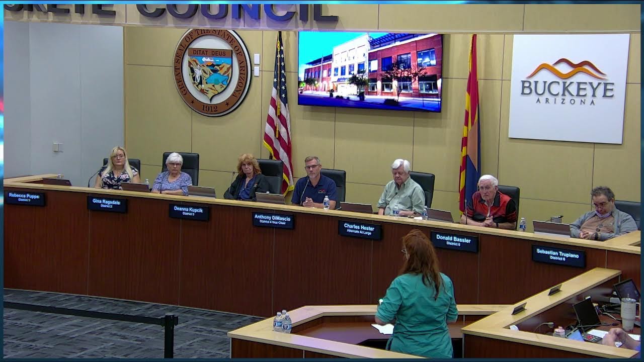
Buckeye Planning Commission Approves FirstNet Cell Tower; Hears Major 11,600-Unit Master Plan Rezoning
Planning commission unanimously approved an AT&T cell tower conditional use permit and heard formal presentation on The Cascade, an 11,600-unit master plan rezoning.
Buckeye Planning Commission Approves FirstNet Cell Tower; Hears Major 11,600-Unit Master Plan Rezoning
The Buckeye Planning Commission unanimously approved an AT&T FirstNet multi-carrier telecommunications facility at its regular session and formally presented The Cascade, an 11,600-unit mixed-use master plan development that will remove 271 acres from the existing Eliano CMP and establish a new planned area development near Tartesso. The cell tower received no public opposition and moved swiftly; The Cascade entered the public hearing phase with a recommendation to city council pending.
Key Speeches
"First net is dedicated public spectrum that only first responders have the ability to use so they're not competing over commercial bandwidth with the rest of us." — Mike McLaughlin, Western Fire Chiefs Association (retired fire chief, California)
"Our hope in this is typically the way these projects work is a single carrier will put out to have the project built. And then with the goal with the height of this would be adding additional carriers and marketing it to Verizon and T-Mobile as well with the hope of being able to get all three on one tower." — Mike McLaughlin, Western Fire Chiefs Association
Timeline
AT&T FirstNet Cell Tower (PLZU-26-001):
- Staff presentation: Multi-carrier telecommunications facility at Village on Broadway retail center; 75-foot faux broadleaf tower with 256 sq ft footprint and 1,620 sq ft equipment compound; designed to accommodate additional carriers (Verizon, T-Mobile) at future buildout; 79-foot setback from residential property line (exceeds 1:1 height-to-distance code requirement); 8-foot-2-inch CMU screening wall for equipment; meeting roof parking study submitted; signal mapping shows significant coverage improvement for area.
- Public comment: Zero comments received; neighborhood notification met 300-foot radius requirement; no opposition from Northwood Park Estates HOA or adjacent charter school.
- Commission discussion: Questions on wall height, camouflage selection (faux broadleaf tree chosen to match existing residential vegetation to west and south), multi-carrier phasing, climbing safety near high school, and residential notification. Staff and applicant representative addressed each concern; climbing hazard mitigated by short stub branches (1.25 inches), plastic sleeves, intentional tight spacing, non-weight-supporting design, and 15–18-foot height to first limbs.
- Vote: Unanimous approval with conditions A–E (specific conditions not detailed in transcript).
The Cascade Master Plan (PLZU-26-003 and companion PAD rezoning):
- Staff presentation: Major CMP amendment to remove 271 acres from Eliano CMP (approved early 2000s); concurrent rezoning of same 271 acres to new Cascade PAD establishing 11,600 dwelling units maximum and 115 acres non-residential; located east of Sun Valley Parkway near Tartesso. Applicant Bill Lally, Tiffany and Bosco, represents multiple property owners. Development standards, design standards, open space, and circulation included in PAD. Surrounding area comprises unimproved desert and five to six master plan communities (most from 2000–2005, largely undeveloped). General plan designates area primarily as master plan community with pockets of neighborhood and business/commerce. Western Eliano parcel (yellow/pink on exhibits) remains in existing CMP; eastern parcel (blue) shifts to new Cascade PAD. Unit density and allocation remain consistent with existing entitlements.
- Commission discussion: None yet (presentation phase only).
- Vote: Pending public hearing and formal recommendation vote.
Project Details
AT&T FirstNet Cell Tower:
- Case number: PLZU-26-001
- Applicant / developer: AT&T Mobile (Spiker Holdings / Buckeye LLC, owner)
- Location / address: Village on Broadway retail center, northwest corner of Miller Road and Broadway Road, west of Miller Road
- Current zoning: Commercial Center (CC)
- Tower height: 75 feet (designed to accommodate up to 100 feet with additional carriers)
- Tower footprint: 256 square feet
- Equipment compound: 1,620 square feet
- Screening: 8 feet 2 inches tall CMU wall; faux broadleaf camouflage with tree-bark textured pole and plastic-sleeved stub branches (1.25 inches, non-weight-supporting, closely spaced for anti-climb design)
- Setback: 79 feet from residential property line (exceeds 1:1 height-to-distance requirement)
- Spectrum: FirstNet-dedicated public safety (first responders only); currently AT&T; capacity for Verizon and T-Mobile future buildout
- Parking: Remaining parking in compound area deemed sufficient per applicant's parking study
- Notification: 300-foot radius; zero comments received
The Cascade Master Plan:
- Case numbers: PLZU-26-003 (CMP amendment); companion PAD rezoning (specific case number not stated in transcript)
- Applicant / attorney: Bill Lally, Tiffany and Bosco (on behalf of multiple property owners)
- Location: East of Sun Valley Parkway, proximity to Tartesso, Buckeye, AZ
- Current zoning: Eliano CMP (portions to be amended/removed)
- Proposed zoning: Cascade PAD (new planned area development)
- Acreage affected: 271 acres removed from Eliano CMP; relocated to new Cascade PAD
- Maximum dwelling units: 11,600 (may be less)
- Non-residential: Up to 115 acres
- Surrounding context: Five to six master plan communities approved 2000–2005; most remain largely undeveloped; surrounding area unimproved natural desert except Tartesso
- General plan designation: Primarily master plan community; pockets of neighborhood and business/commerce
- Development standards: To be included in final Cascade PAD document (design, open space, circulation standards included)
Vote Breakdown
AT&T FirstNet Cell Tower (PLZU-26-001):
- Final: Unanimous approval
- Conditions: A–E (specific conditions not detailed in transcript)
- Individual votes: Not stated in transcript; no opposed votes recorded
- Vote method: Voice vote ("All in favor? Say aye. Aye. Aye. Any opposed? Motion carries.")
The Cascade Master Plan (PLZU-26-003 / PAD rezoning):
- Status: Public hearing and recommendation vote pending
- Individual votes: Not yet taken
Opposition
AT&T FirstNet Cell Tower: No organized opposition. Zero public comment cards submitted. No comments received by applicant during required neighborhood meeting. No outstanding comments from reviewing departments. Northwood Park Estates HOA (to west and north) was notified within 300-foot radius but did not submit opposition or concerns.
The Cascade Master Plan: Public hearing phase only; opposition (if any) not yet formally presented.
Support
AT&T FirstNet Cell Tower:
- Western Fire Chiefs Association: Endorsed FirstNet public safety mission; Mike McLaughlin, retired fire chief of California, stated partnership with Buckeye Fire Department to bring site to fruition. Emphasized FirstNet's exclusive spectrum for first responders, reducing competition for commercial bandwidth during emergencies.
- Buckeye Fire Department: Identified as partner in project development (per McLaughlin statement).
- Staff recommendation: Approval recommended based on compliance with general plan (neighborhood land use), consistent character with area, demonstrated need for tower, and met height/setback/design criteria.
Outcome & Next Steps
AT&T FirstNet Cell Tower: Unanimously approved with conditions A–E. Case closed; applicant may proceed to site plan approval and construction subject to condition compliance.
The Cascade Master Plan: Requires two separate formal actions per planning code: (1) Major CMP amendment (PLZU-26-003) removing 271 acres from Eliano CMP, and (2) PAD rezoning establishing new Cascade planned area development with 11,600-unit maximum and 115 acres non-residential. Public hearing period remains open; planning commission will conduct formal public hearing(s) and issue separate recommendations to city council. Staff indicated both items relate to same project and will be presented together. Separate motions and separate recommendations to city council required before final approval.
Controversies & Context
Cell Tower Climbing Safety: One commissioner raised concern about proximity to adjacent charter high school and potential for student climbing. Staff and applicant representative clarified that faux broadleaf design includes stub branches intentionally designed to be non-climbable (1.25-inch stubs in plastic sleeves, closely spaced, non-weight-supporting) and that similar open-air sites exist throughout Phoenix valley without climbing incidents. Commissioner accepted assurance but expressed heightened concern given school proximity.
Design Aesthetics: Commissioner questioned selection of faux broadleaf camouflage, noting potential visual incongruity next to commercial building. Staff responded that existing trees in adjacent residential neighborhoods to west and south informed camouflage choice to maintain consistency with neighborhood character.
Cell Tower Setbacks: Commissioner questioned why setback requirement (75 feet) applies to residential property lines but not to buildings or structures (e.g., the charter school building). Staff clarified that development code setbacks are codified by previous code version (applicable per pre-application conference rules) and noted that while setbacks historically referred to "fall zones," modern code interpretation emphasizes visual impact reduction on adjacent residents rather than physical fall hazard, as modern cell towers have negligible failure rates.
The Cascade Scale & Context: The 11,600-unit development represents a major residential rezoning request in a region where surrounding master plans from the early 2000s (approved simultaneously with Eliano CMP) have remained largely undeveloped for 20 years. Tartesso is the only developed major project in the area; the remainder is unimproved natural desert. This phasing disparity may inform future discussion regarding infrastructure, water, and service capacity.
Duration
- AT&T FirstNet Cell Tower item: Approximately 25–30 minutes (presentation, multiple commissioner questions, public hearing, vote)
- The Cascade presentation: Approximately 10–15 minutes (staff presentation only; public hearing and vote deferred to future session)
- Total meeting duration: Not stated in transcript
Other Notable Items
None identified beyond the two principal items (AT&T cell tower and The Cascade master plan).
═════════════════════════════════════════════════════════════════════════════════════
View source transcript ▼
Source: 1ZldAW_gMfQ.en. Auto-generated YouTube transcript; may contain transcription errors.
You company representing AT&T Mobile on behalf of Spiker Holdings, Buckeye LLC, the owner. This site is located west of the northwest corner of Miller Road and Broadway Road within the Village on Broadway retail and commercial development. The applicant is requesting a conditional use permit, excuse me, to allow a new multi-carrier telecommunications facility. It does include a 75-foot foot tall faux broadleaf tower. This will be occupying as proposed to occupy a 256-square-feet lease area.
There is also a separate associated 1,620-square-foot lease area for their associated equipment. The applicant did request this application be reviewed and considered under the requirements of the development code in effect at the time of the pre-app conference. This is allowed into the provisions of section 1.8.2 of the development code.
So the subject site indicated by that red polygon is located again at the corner of Miller and Broadway and again there are two lease areas proposed shown by the red arrows up there. The area to the south is where the proposed site for that actual tower is and the northeast parcel portion there is the proposed site for the associated equipment compound. This parcel is part of the Village on Broadway retail center.
So please be aware that although it is a commercial zoning district, the building is currently rented and being used as a charter school, not a commercial use as indicated in the staff report. So to the east and to the south is the remainder of that little John Broadway retail development. Also to the south, further the south is a portion of the Copper Falls community. It's currently being used for agricultural purposes.
The neighborhood of northwood parkestates lies to the west as well as to the north. The subject site in the red polygon and areas to the east, west and north are designated as neighborhood is indicated in yellow. The property to the south of Broadway is designated as master plan community. The neighborhood land use indicates both residential uses as well as uses that contribute to the health and livability of neighborhoods.
So the subject site and surrounding development to the east and south are within the commercial center zoning district indicated here by the peak shading and a small portion of that parcel does extend all the way south to Broadway road where further to the south of that portion is planned community that is the Copper Falls community. To the west and the north is rural residential zoning district that's indicated by that darker green shade of green.
So the commercial center zoning does permit telecommunications powers with a conditional use permit. So this is a proposed site plan. This is a separate approval that does require this conditional use permit to be approved prior to approval. As stated before, this lease area is consists of two separate sites. Going in closer on your left is the larger lease area that is to the north of the building.
It's anticipated to occupy 1,620 square feet where there is existing landscaping and parking spaces. The applicant has submitted a parking study indicating that the remaining parking is sufficient. The lease area on the right hand side is for the tower that is the 75 foot mono broadleaf cell tower as proposed on the south side within the and existing landscaped area.
The development code in effect at the time of the pre-ab does require cell towers to be set back a distance equal to the height of the cell tower. That's not including any stealth apparatus from any residential property line. So this site plan proposal does provide for a step back of over 79 feet which does meet that one to one height to distance ratio. The maximum height for cell towers in CC zoning is 75 feet with an additional 25 feet allowed for each additional carrier.
So the proposed 75 foot cell towers designed to accommodate one additional care in the future. This would allow a height of up to 100 feet. The proposed tower is 75 feet and under and well within the allowable height to meet that setback requirement.
As seen on the left, the cell tower is proposed to be camouflaged as a faux broadleaf with additional landscaping around the base as well as the pole having additional camouflage in the form of textured and painting to more closely resemble tree bark. The compound on the north side is proposed to be enclosed and screened by a CMU wall that matches the color and texture of the existing development.
So in addition to meeting any setback requirements and height restrictions, another requirement is for the applicant to demonstrate a need for a cell tower. So these images do show the difference in signal strength, red indicates stronger signal strength, showing that the addition of the proposed cell tower will provide much better signal strength and coverage for the community in that area.
I did want to point out please note that AZL01654M towards the center of both images is not yet built so the cell phone coverage right now is actually less than what is shown for without proposed facility. So all public participation requirements were met by the applicant including a neighborhood meeting and noticing. We received no comments pertaining to this conditional use permit and no comments received by the applicant as well.
So this conditional use permit again was reviewed under the previous requirements of a previous addition of the development code. It was reviewed for consistency with governing documents and it was found that it is compliant in compliance with the general plan neighborhood land use as it would support the surrounding uses and contribute to the livability of the communities. And that I tell the communication facility is permitted in CC zoning with a conditional use permit.
Further the applicant has demonstrated a need for another cell tower and the associated site plan shows that the height, setbacks and design criteria are met and are consistent with the character of the area. The use is not anticipated to disrupt the surrounding area and there are no outstanding comments from reviewing departments. Based on these findings staff recommends approval of case PLZU-26. I'm sorry, death 0, 0, 0, 1. Subject to conditions A through E.
And if you have, I am available for any questions as well as representatives from the applicants company if you have any questions. Does applicants have anything they want to share or speak before? All right, we'll go to the commissioners. Do you have any questions or comments? Yes, I wanted to ask, you mentioned something about a wall and you showed a picture of that depicting that. So how tall is that wall? It's eight foot and two inches I believe.
So kind of hide the lower part, the trunk part. Correct, it's to screen the telecommunication equipment. Yes, commission. And then it's AT&T responsible for the upkeep and making it look aesthetic and everything over time. Yes, commission. What other is Verizon in this at all with them? Or just curious. You didn't mention multiple use? I know you said multiple, yeah. Good evening, Chair commission. My name is Mike McLaughlin.
I work for the Western Fire Chiefs Association, retired fire chief of the state of California. And we work in partnership with public safety towers. And we've been working in partnership with the Buck Eyte Fire Department as well and bringing this site to fruition. This particular site is an AT&T first net site.
First net is dedicated public spectrum that only first responders have the ability to use so they're not competing over commercial bandwidth with the rest of us, including myself because I'm no longer active. Our hope in this is typically the way these projects work is a single carrier will put out to have the project built.
And then with the goal with the height of this would be adding additional carriers and marketing it to Verizon and T-Mobile as well with the hope of being able to get all three on one tower. But currently it's first net and AT&T only. Okay, thank you, sir. I think that's all my questions. Thank you, Ms. Cooley. Ms. Ragsam. No questions, thank you. Ms. Cupsick. Trisha, the map where it showed other cell towers are those all just the public safety ones?
Is that because there's one in just Sinsky that's right down the street. And I just wondered why that wasn't there. But Radio frequency engineer, I'm a consulting engineer in the industry. So the towers if I didn't get quite the tail end of the question. But basically all the sites within here are multiple different owners, multiple different types of sites. It's not all this public safety tower. It can be a variety of tower companies or the carriers themselves. Okay, okay.
I just wondered why it wasn't there. No big deal. Thank you. Appreciate it. No questions. I didn't need for the tower there. I'm just wondering if other styles were looked at because that tree style is going to look a little out place there, especially right next to the building. Like I said, I can see the need for it. Just curious about how that was picked. Commissioner, there are existing trees in the residential neighborhood to the west and to the south. Within the residential neighborhoods.
So it was deemed that that would be an appropriate camouflage technique commissioner. There a question I have which I can't remember with the conditional use permit. How far out does the notification go? 300 feet. Any chances went out to the Northwood Park States HOA because they are very proud of their neighborhood. Commissioner, it went to the list included everyone within 300 property owners within 300 feet of the the parcel, not just the sites, but the parcel.
Okay, the parcel 300 feet from the edge of the the red line. Correct. Okay. All right. I just wanted to make sure that notification was sent to the fine folks there. I do not have a commissioner. I don't have a copy with me of the notification. We do get a mailing list with the reviews. I don't have that with me commissioner. So I do not, I couldn't verify whether or not the HOA itself. If the HOA does own property within that 300 feet, they would have received a letter.
Yeah, as long as there's enough people in there got informed with the 300 feet from the boundary, that's good. They like to talk amongst each other. So just making sure that won't be problems down the line. Thank you. I just had a question. We should have dimensioned to the residents. Couldn't be obviously if it fell over. What it could be as high or had it be further away than the height. How come it's not from a building? I'm sorry. The setback to residential was what? Yeah, 75 feet.
I just curious why it isn't the same like to a building or structure or something. I'm assuming it's case it falls over or whatever, but commissioners. This curious. That's what's dictated by the development code, the previous, the development code and effect at the time of the pre-app conference. It is, we have called it a fall zone before, but it is identified as a setback and the development code. Yeah, Chair, I can maybe elaborate.
I'm not going to say there aren't instances where you can prove this wrong, but we're past the point where these things are falling over regularly. So maybe the original reason for having some of the setbacks were related to a fall zone, but really the purpose for maintaining a setback in our current code is purely to reduce any visual impacts on the adjacent residents. That's number one. There's a very almost non-existent chance that this falls over at any point in time. Good to hear.
I have one more question. This is next to the charter high school. As we know high school students don't always do the best thing for themselves. Okay, sorry. This is next to a charter high school. As we know high school students don't always do what's best for them. What's going to prevent people from climbing the students or other people from climbing this right next to the building?
Because a lot of these cell towers are fenced in, and this one I don't think it doesn't look like it's going to be fenced in. I'm commissioner from what I understand, and please correct me if I am mistaken. There it's a round pole. So it would be the same as they could try and climb it like they could climb a tree, I suppose. Okay, there's 90 hooks or anything to grab on. It's about 15-18 feet to the branches.
The branches are a stub about an inch and a quarter long, and then it's got like a plastic sleeve that goes over it. So you've got an inch about an inch to climb. The branches are intentionally placed close together so that you can't really climb between the spaces. The limbs are not weight supporting. They come right off. The knobs very short. The climb and there's sites like this that are in the open all over the valley, and there's no problems with them. Yeah, I just know.
I know they're all in the valley, but this is just proximity to a high school, kind of worried me a little bit. But if you guys already looked at the safety aspect, I'm going to go with that. Okay. At the time I'll open it up for a public hearing. Madam Secretary, do we have anybody wishing to speak on this? I have no absolute any speaker cards. All right. I'll close this public hearing.
And at this time, Vice Chair, with the public hearing being closed, if there are no further discussion items, you could call for a vote. Thank you, ma'am. All right. At this moment, we'll call for a vote. Chair, I'd like to make the motion to accept Buckeye A-Z-0281 conditional use permit P-L-Z-U-26-001 with the conditions A through E. I'll second to move then second. All in favor? Say aye. Aye. Aye. Any opposed? Motion carries. Next item. Thank you. Next item 3B. Lanto.
This is going to be a big one for you, Ken. Major community master plan, CMP. Case number P-L-Z-26-003. This is a public hearing request that planning zoning commission recommend approval to the city council of a major amendment removing approximately 271 acres from the CMP. Mr. Glicka, would you like to speak? Yes, thank you, Chair. So with your permission, I will be presenting the last to hearing items on the agenda together. Tonight, they both relate to the same project.
At the end, there will be required two separate motions, two separate public hearings, and recommendations to the city council. But both of these items are related to a project that is now being called the Cascade, and I'll show you exactly where that's located. The first being a major CMP amendment, the second being a rezoning to planetary development.
The applicant for both of these applications is Bill Lally with Tiffany and Bosco on behalf of multiple property owners within these various zoned areas. The first request I mentioned is the community master plan amendments to the amendment as to the existing CMP called Eliano. Which is located, and I'll show you in a map, and just a second off, a Sun Valley Parkway, basically in the proximity to Tartaso.
The CMP amendment would remove 2771 acres from that PAD, which was approved, excuse me, from that CMP, which was approved in the early 2000s. The reason for that is moving into request number two. Basically, we would take that upon removal, we'll take that 2771 acres, and then rezone that to a new planned area development called the Cascade.
And that will establish a new plan, land use plan, development standards, the whole works, for a residential focused master plan community with 11,600 dwelling units maximum could be less, and then up to 115 acres of non-residential development. All the development standards design standards, open space circulation are included within this as well. And general locations probably easer to show you on a map. All three of these exhibits include boundaries shown in two colors on the far left two.
You can see shapes drawn in yellow and blue on the other one on the far right side, pink and blue. The blue area is the portion for concerning request number two. That will be the area east of Sun Valley Parkway, and that will be the area that is included in the new the Cascade planned area development. The yellow, or in the case of the right exhibit there, pink, rectangles, those are the areas within the existing Elianto CMP that will remain in that CMP.
So just to walk you around the area, not a whole lot other than Tartesso in this area currently you can see most of the surrounding area is unimproved natural desert with the exception of Tartesso. There are multiple master plan communities.
Most of them approved right around 2000, 2005 within the surrounding area, basically each of these colors you can see here, five or six different master plan communities, most of which, quite frankly, haven't proceeded toward development really in the last 20 years. And then lastly, the the general plan land use map. Most of the area reflective of all those approved master plans is designated in the general plan as master plan community.
Some exceptions, pockets of the yellow color, which is neighborhood and the red, which is business commerce. So the easy part of the request is the first one, Elianto Major CMPA. The purpose of this is solely to remove the 2771 acres east of Sun Valley Parkway from that CMP, leaving just the portions on the west side of Sun Valley Parkway with those entitlements. This is the portion that will be included in the second part of the request, the cascade.
Outside of removing those acres, there are no additional changes to any of the standards that are currently allowed on the western portion that are proposed this evening. And the density allowances and unit allocations would be consistent, remain consistent.